Visualising the Conflict
Geographic Information Systems (GIS) Maps
Map Set 13:
Deaths at 1km Grid Squares |
| Map Set 13: Deaths at 1km Grid Squares - Introduction |
Maps - Deaths, by area (Northern Ireland, Belfast, Derry), by 5 year groups, at 1km grid square level (24 maps)
See also: Animations (3 animations)
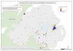
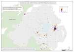
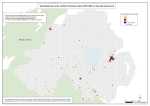
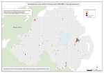
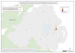
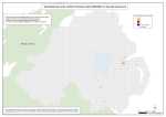
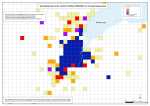
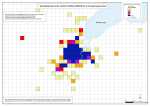
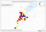
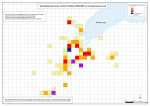
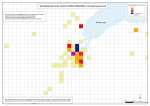
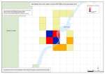
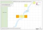
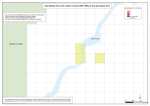
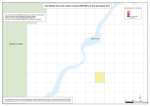
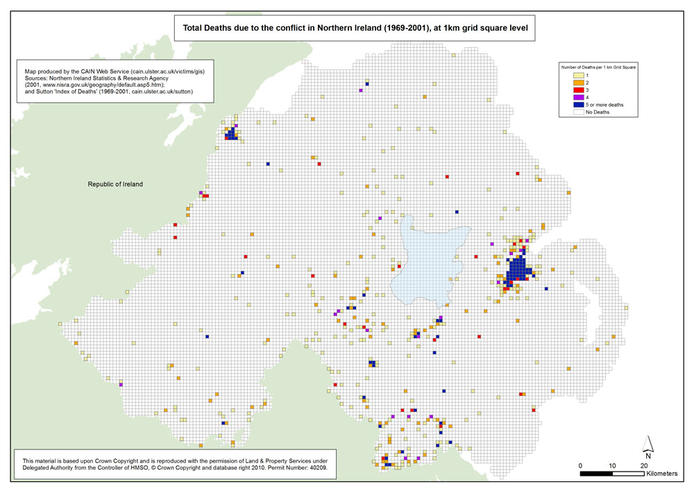
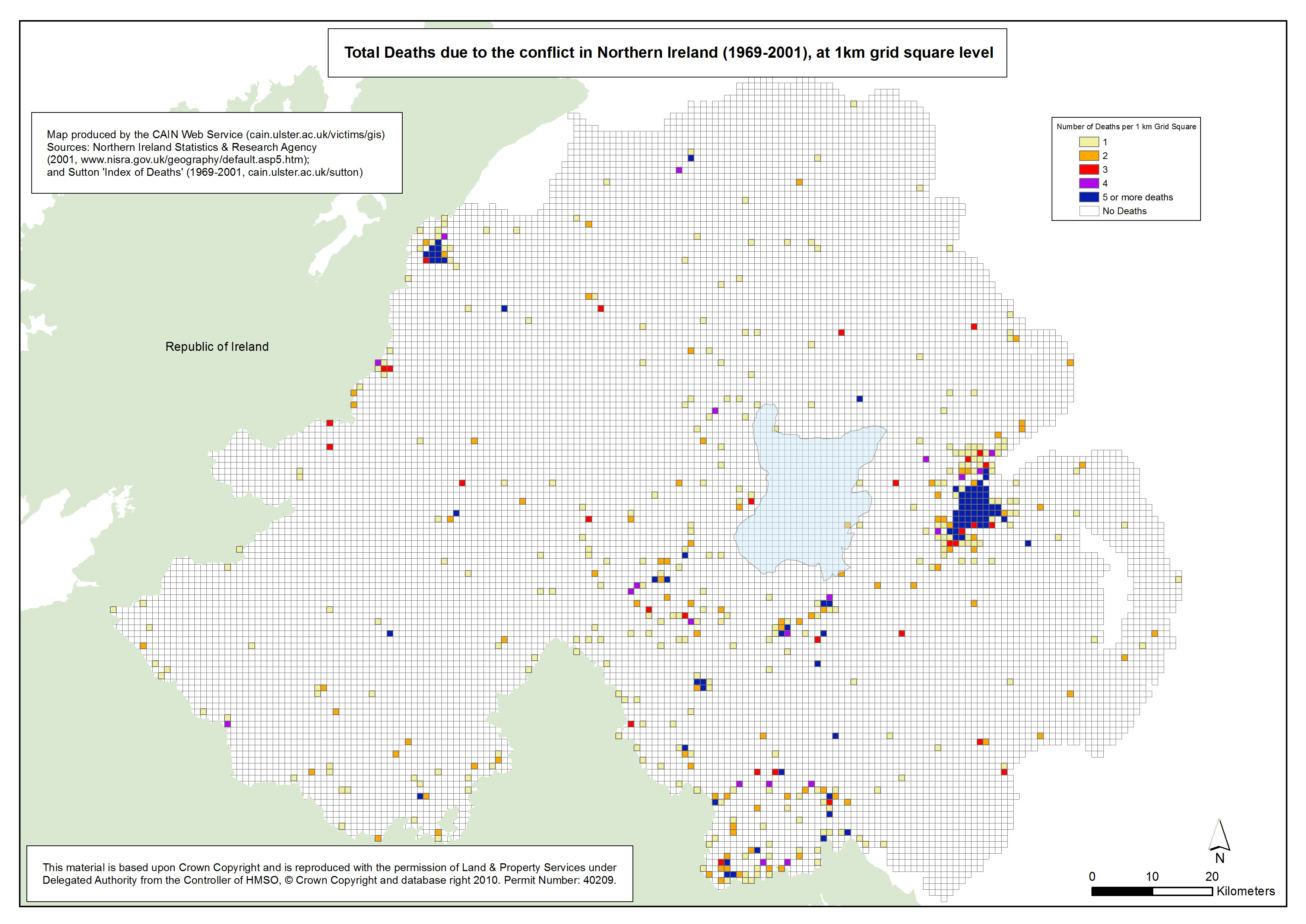
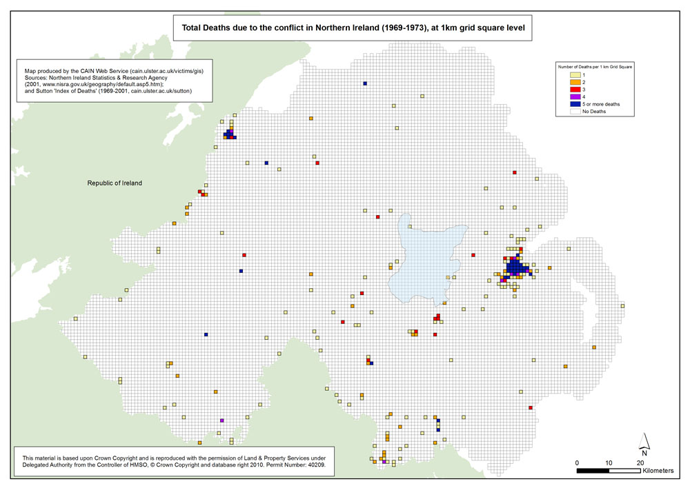
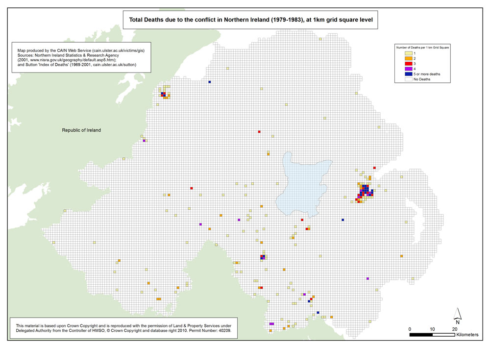
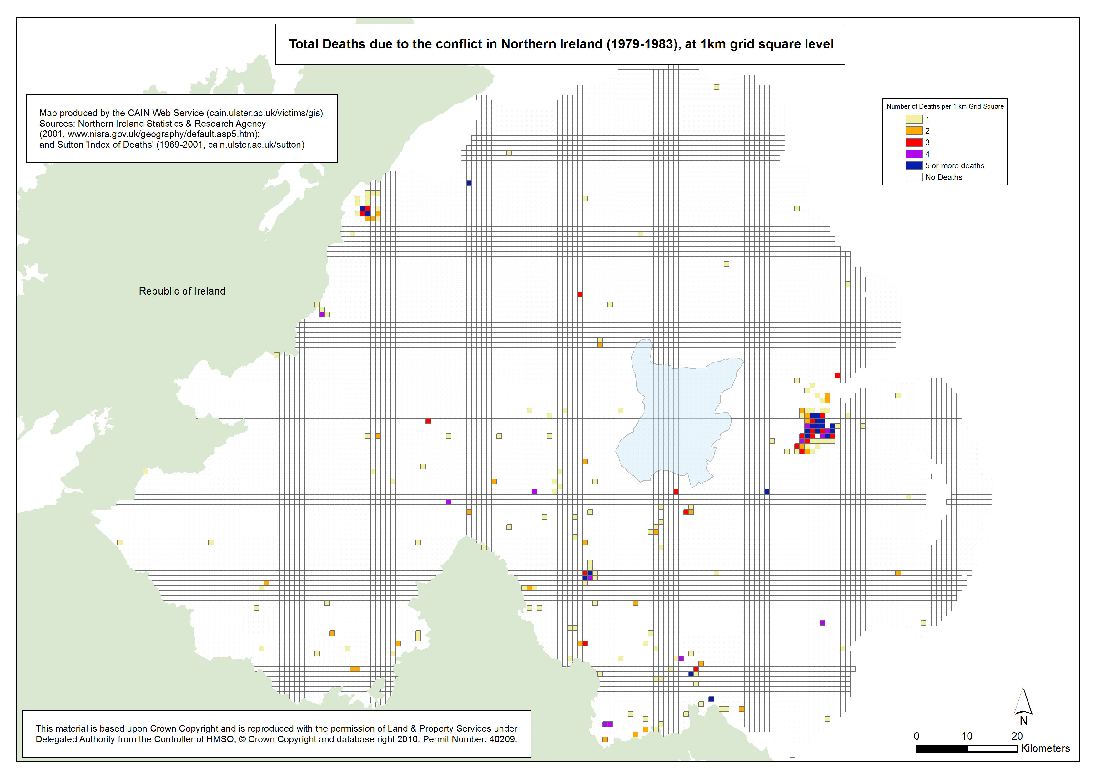
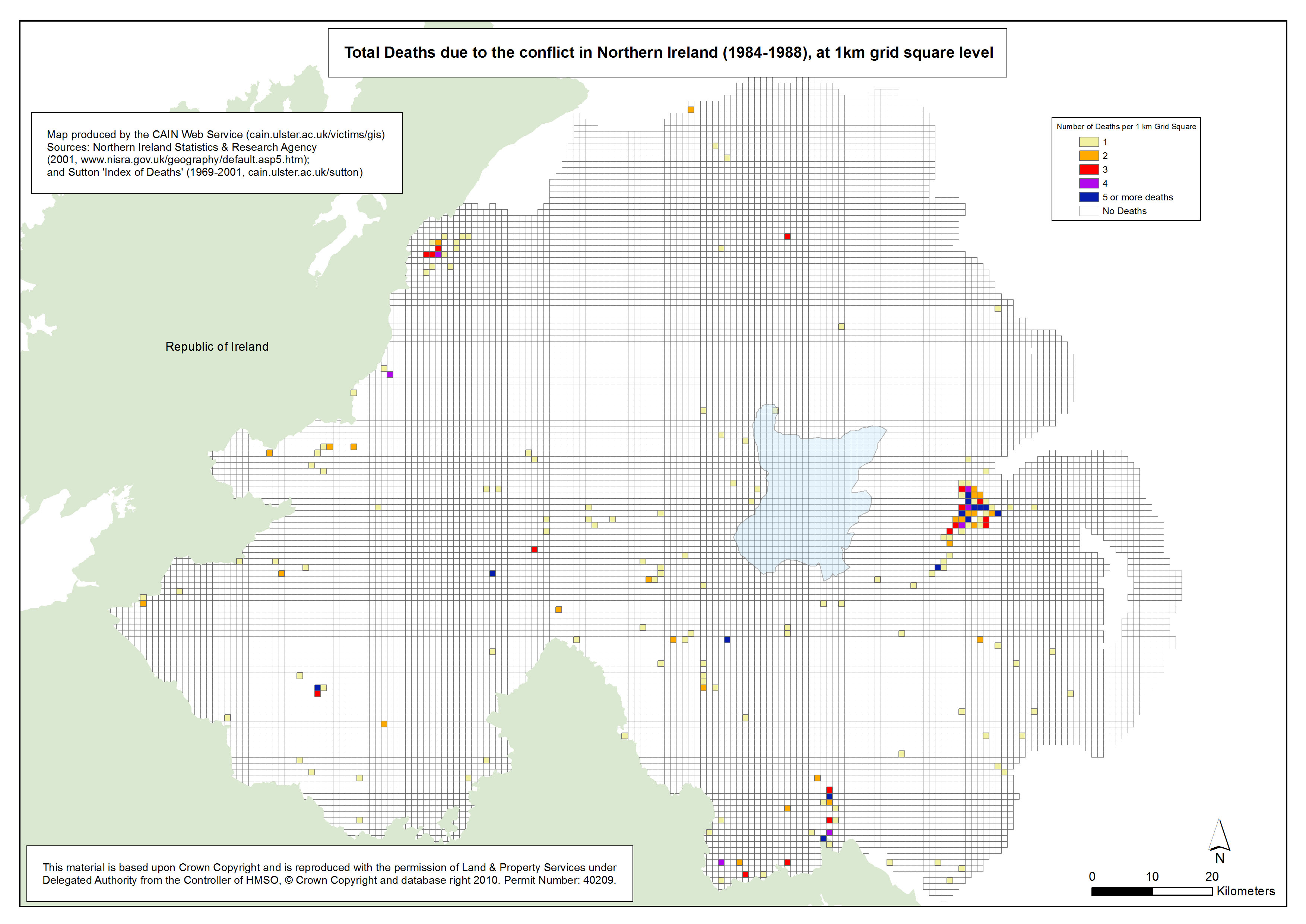
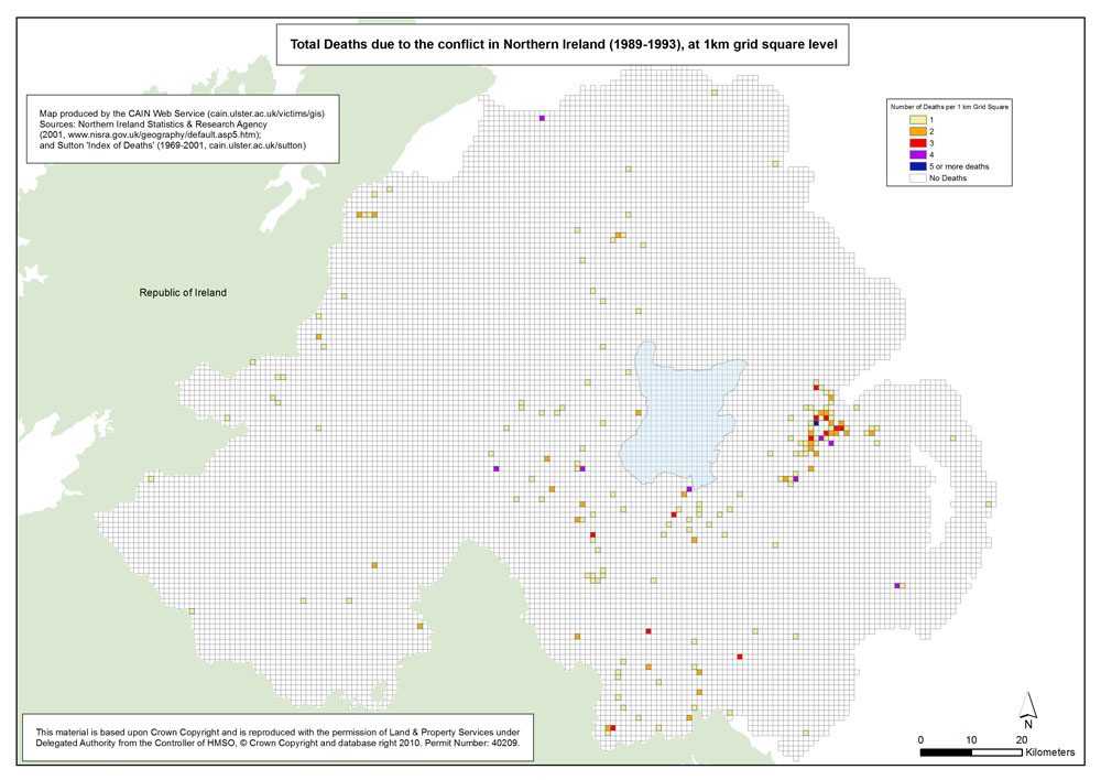
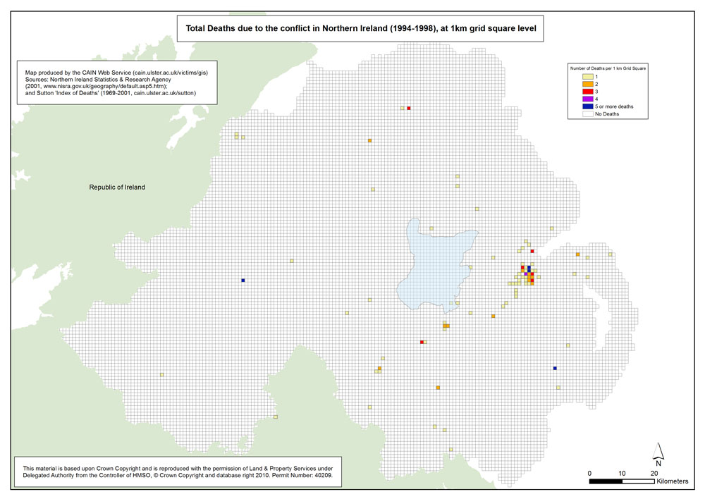
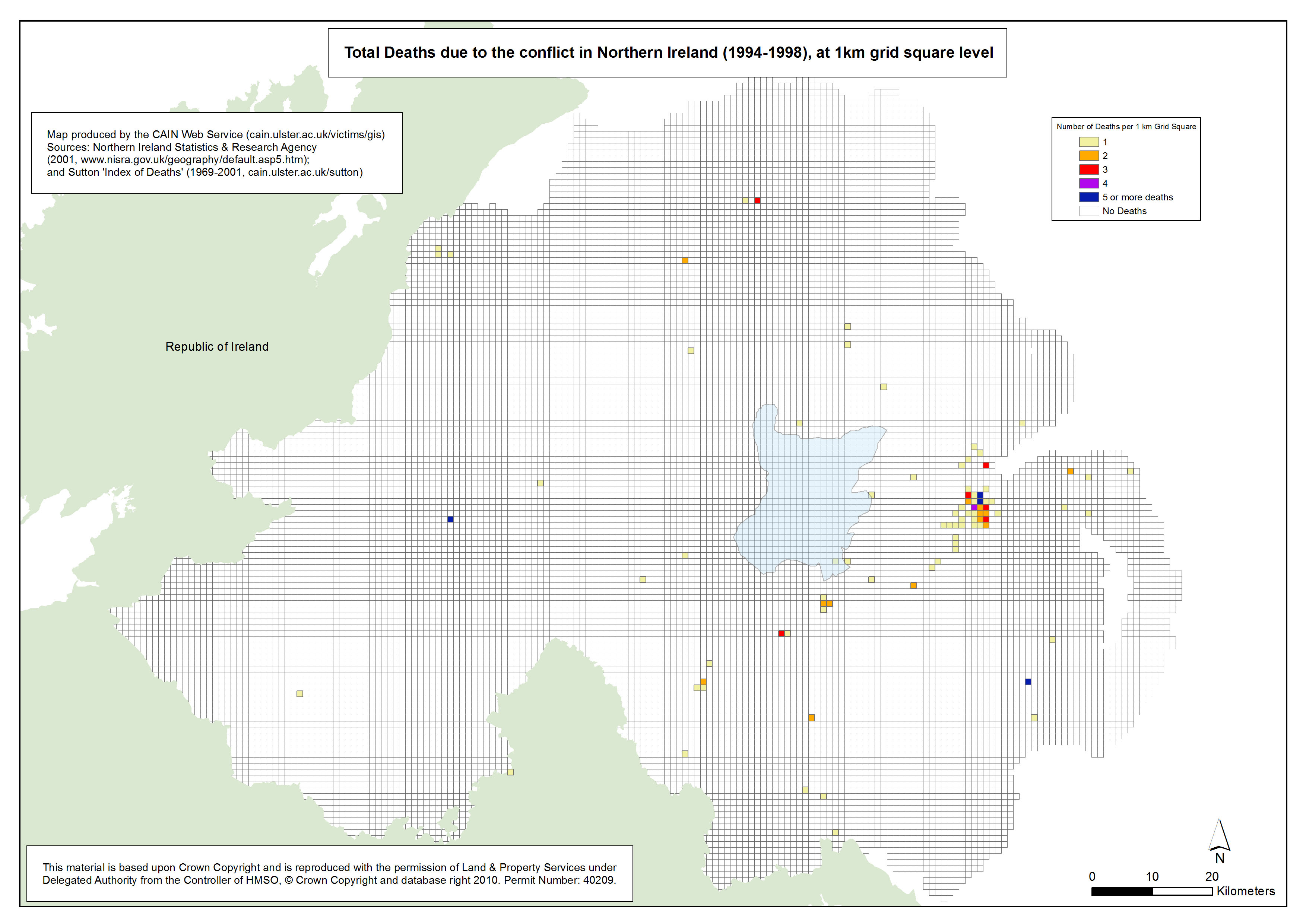
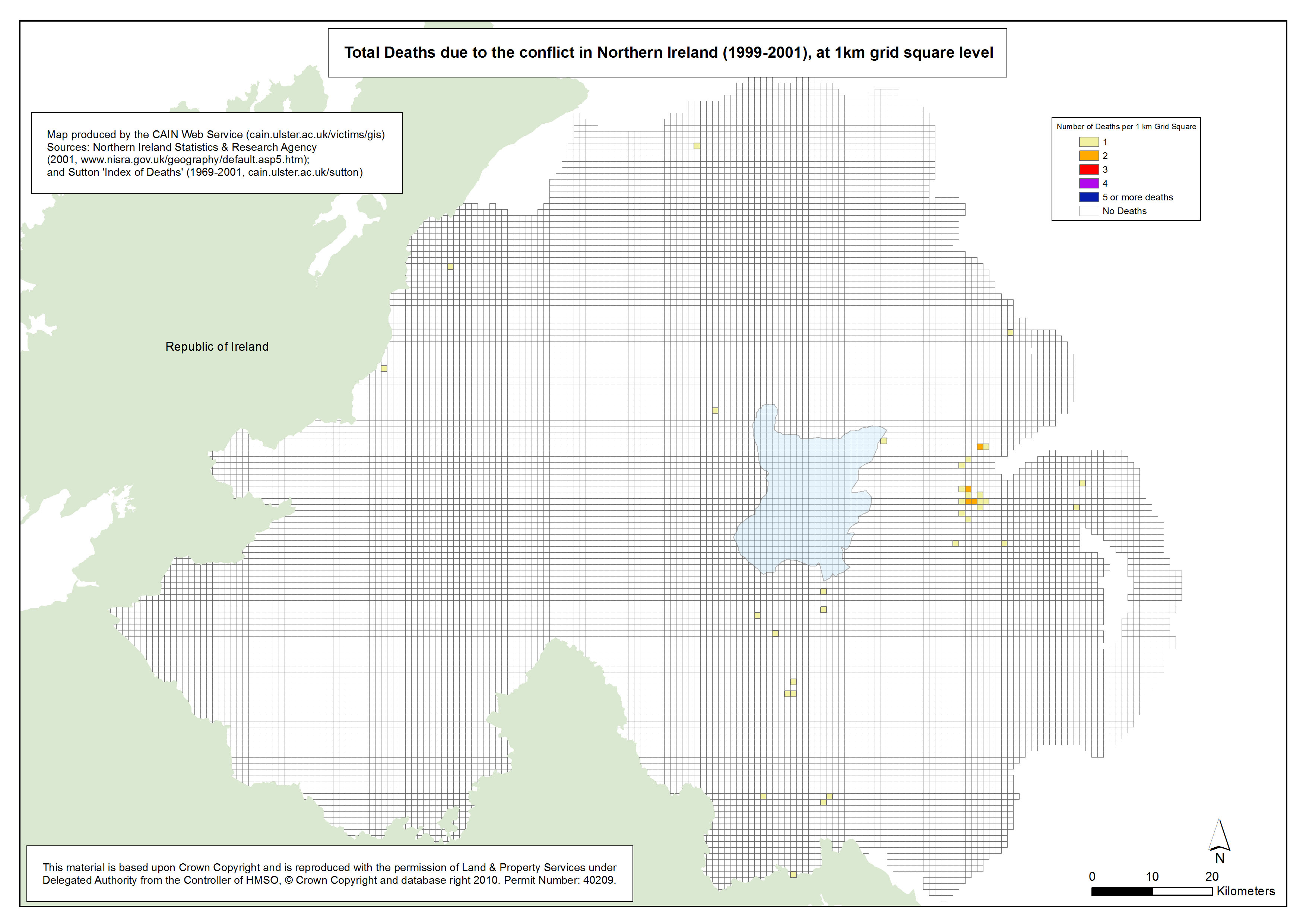
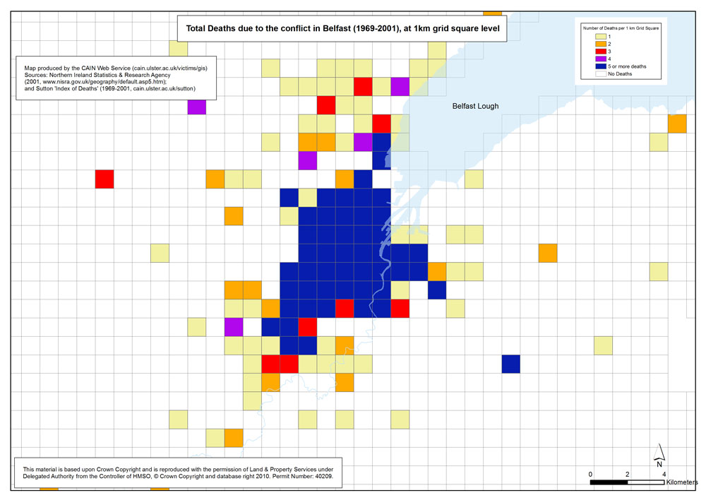
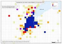 These sets of maps show the total deaths due to the conflict in Northern Ireland at 1 kilometre grid square level. The 1 kilometre grid square shapefile was downloaded from the Northern Ireland Statistics and Research Agency website. (http://www.nisra.gov.uk/geography/default.asp5.htm) These sets of maps show the total deaths due to the conflict in Northern Ireland at 1 kilometre grid square level. The 1 kilometre grid square shapefile was downloaded from the Northern Ireland Statistics and Research Agency website. (http://www.nisra.gov.uk/geography/default.asp5.htm)
In addition to the three geographical areas – Northern Ireland, Belfast and Derry – the maps plot not only the total number of deaths between 1969 amd 2001 but, in addition, map the number of deaths within 8 different year groupings. These groupings include: 1969-1973; 1974-1978; 1979-1983; 1984-1988; 1989-1993; 1994-1998; 1999-2001.
The information used to name, locate and plot each victim is provided by Malcolm Sutton’s “Index of Deaths 1969-2001” (http://www.cain.ulster.ac.uk/sutton/) .
The number of deaths per 1 kilometre grid square is divided into 6 separate layers, ranging from Nil deaths to 5 or more deaths. In addition to the static maps, a further dimension is provided by an animated version of the maps.
| Maps - Deaths, by area (Northern Ireland, Belfast, Derry), by 5 year groups, at 1km grid square level (24 maps compiled and drawn by Luke Kelleher) |
| Title of Map |
File Version |
| PDF |
L-JPG |
H-JPG |
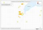
| Northern Ireland |
 Deaths - NI - 1969-2001 - 1km Grid Square Deaths - NI - 1969-2001 - 1km Grid Square
Total Deaths due to the conflict in Northern Ireland (1969-2001), at 1km grid square level |
.pdf
825kb |
.jpg
167kb |
.jpg
1452kb |
 Deaths - NI - 1969-1973 - 1km Grid Square Deaths - NI - 1969-1973 - 1km Grid Square
Total Deaths due to the conflict in Northern Ireland (1969-1973), at 1km grid square level |
.pdf
820kb |
.jpg
160kb |
.jpg
1433kb |
 Deaths - NI - 1974-1978 - 1km Grid Square Deaths - NI - 1974-1978 - 1km Grid Square
Total Deaths due to the conflict in Northern Ireland (1974-1978), at 1km grid square level |
.pdf
819kb |
.jpg
161kb |
.jpg
1436kb |
 Deaths - NI - 1979-1983 - 1km Grid Square Deaths - NI - 1979-1983 - 1km Grid Square
Total Deaths due to the conflict in Northern Ireland (1979-1983), at 1km grid square level |
.pdf
814kb |
.jpg
156kb |
.jpg
1424kb |
 Deaths - NI - 1984-1988 - 1km Grid Square Deaths - NI - 1984-1988 - 1km Grid Square
Total Deaths due to the conflict in Northern Ireland (1984-1988), at 1km grid square level |
.pdf
814kb |
.jpg
155kb |
.jpg
1423kb |
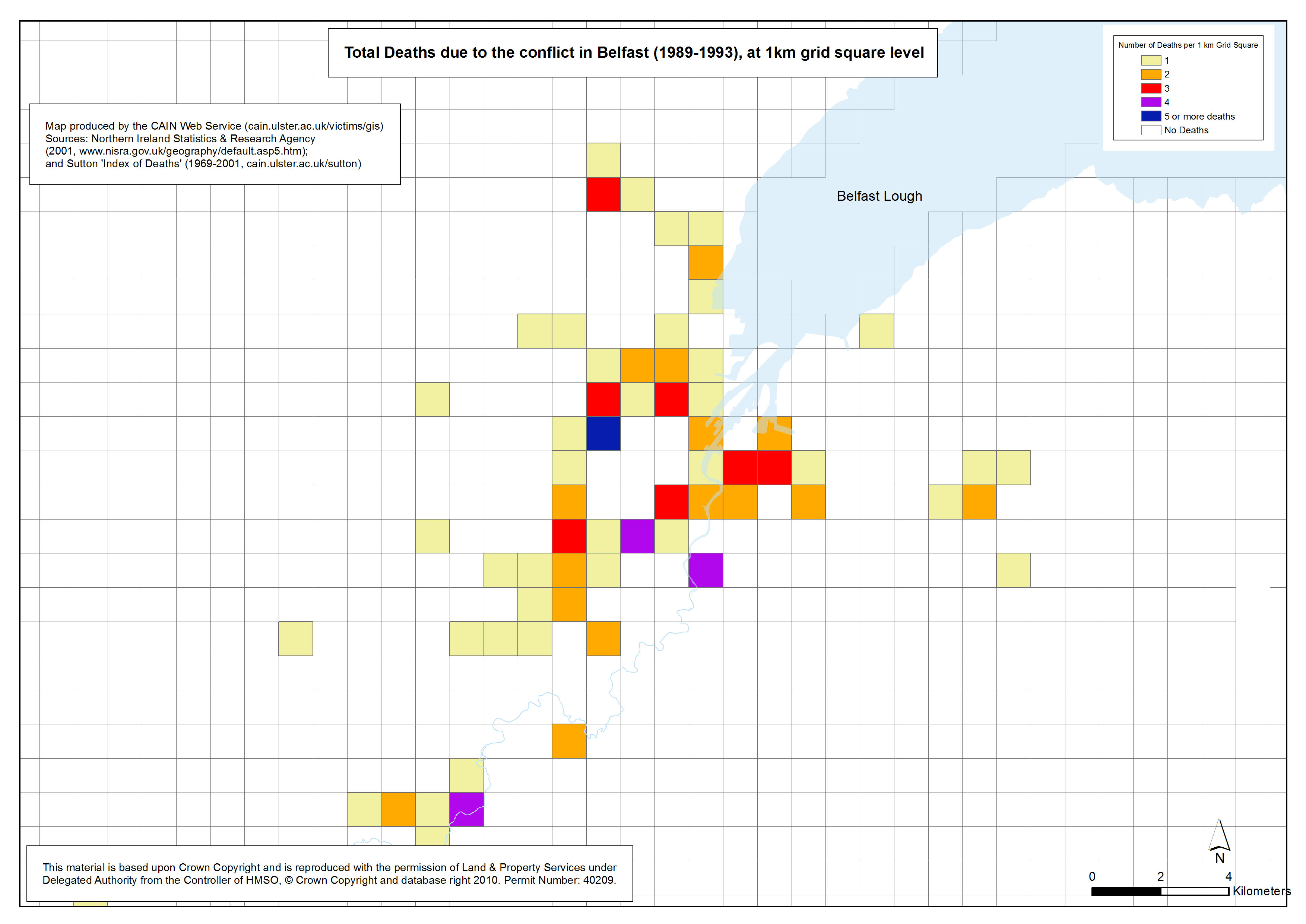
 Deaths - NI - 1989-1993 - 1km Grid Square Deaths - NI - 1989-1993 - 1km Grid Square
Total Deaths due to the conflict in Northern Ireland (1989-1993), at 1km grid square level |
.pdf
814kb |
.jpg
155kb |
.jpg
1422kb |
 Deaths - NI - 1994-1998 - 1km Grid Square Deaths - NI - 1994-1998 - 1km Grid Square
Total Deaths due to the conflict in Northern Ireland (1994-1998), at 1km grid square level |
.pdf
810kb |
.jpg
152kb |
.jpg
1412kb |
 Deaths - NI - 1999-2001 - 1km Grid Square Deaths - NI - 1999-2001 - 1km Grid Square
Total Deaths due to the conflict in Northern Ireland (1999-2001), at 1km grid square level |
.pdf
809kb |
.jpg
150kb |
.jpg
1408kb |
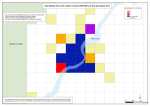
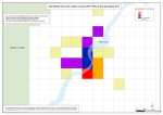
| Belfast |
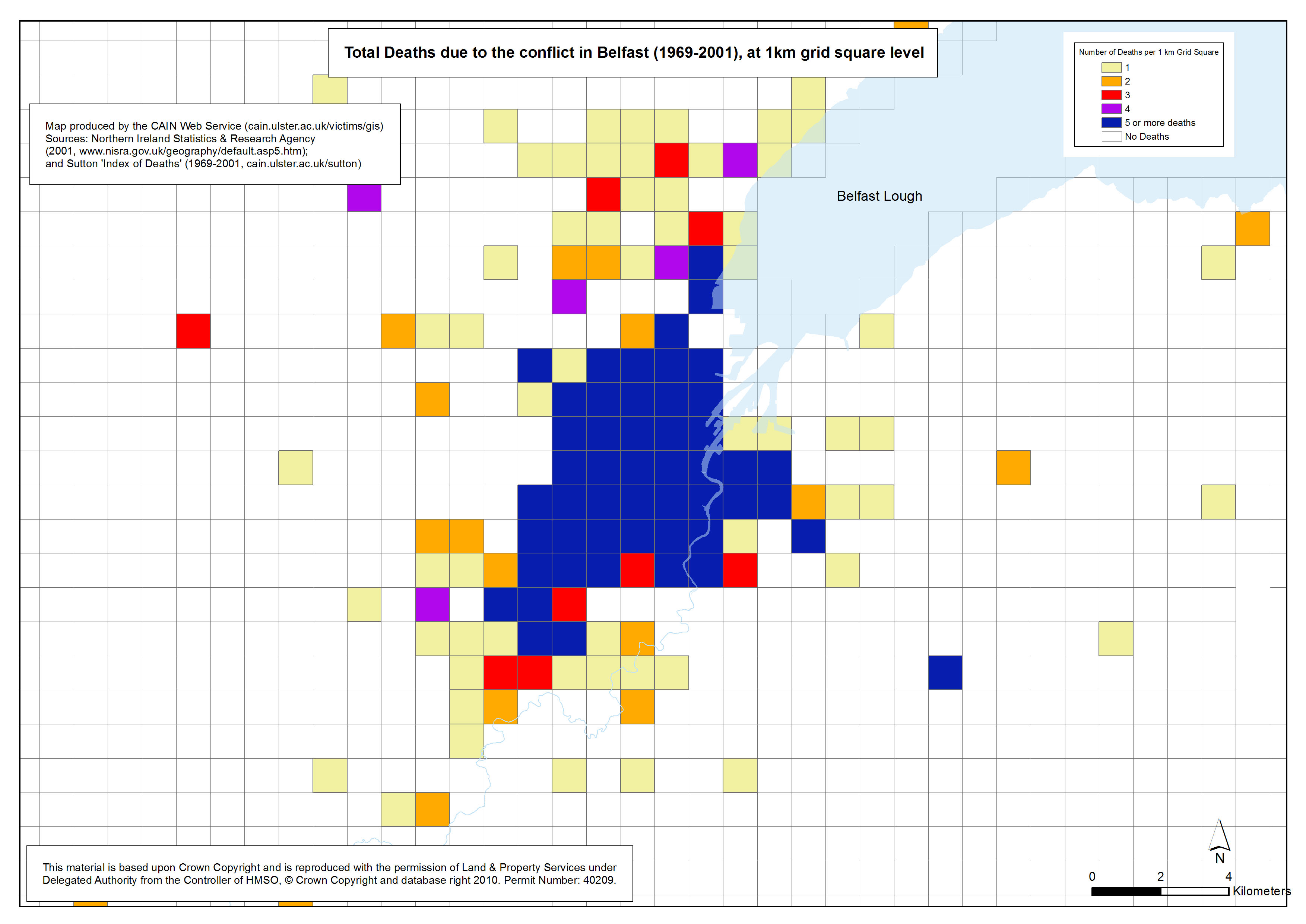
 Deaths - Belfast - 1969-2001 - 1km Grid Square Deaths - Belfast - 1969-2001 - 1km Grid Square
Total Deaths due to the conflict in Belfast (1969-2001), at 1km grid square level |
.pdf
476kb |
.jpg
143kb |
.jpg
847kb |
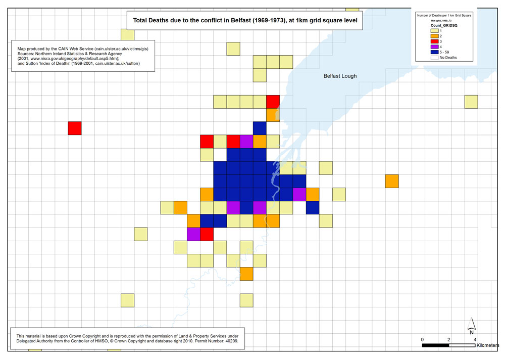
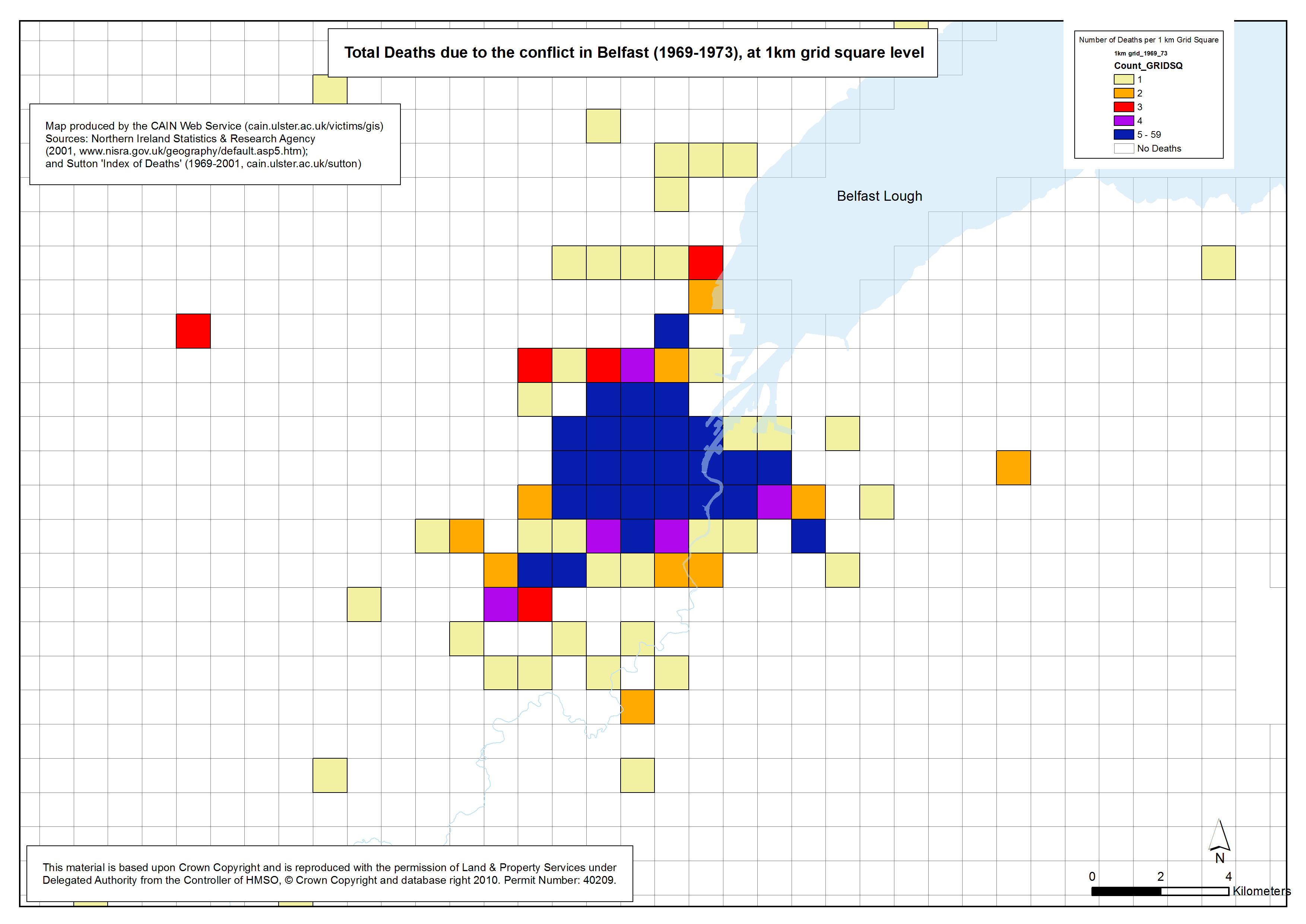
 Deaths - Belfast - 1969-1973 - 1km Grid Square Deaths - Belfast - 1969-1973 - 1km Grid Square
Total Deaths due to the conflict in Belfast (1969-1973), at 1km grid square level |
.pdf
475kb |
.jpg
137kb |
.jpg
828kb |
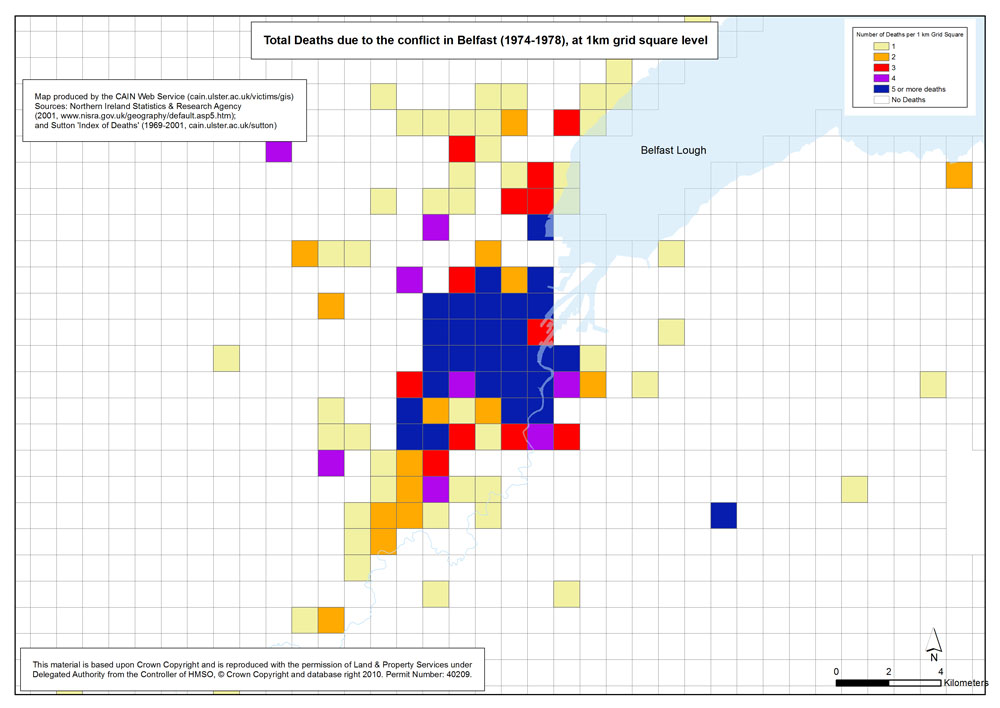
 Deaths - Belfast - 1974-1978 - 1km Grid Square Deaths - Belfast - 1974-1978 - 1km Grid Square
Total Deaths due to the conflict in Belfast (1974-1978), at 1km grid square level |
.pdf
474kb |
.jpg
140kb |
.jpg
837kb |
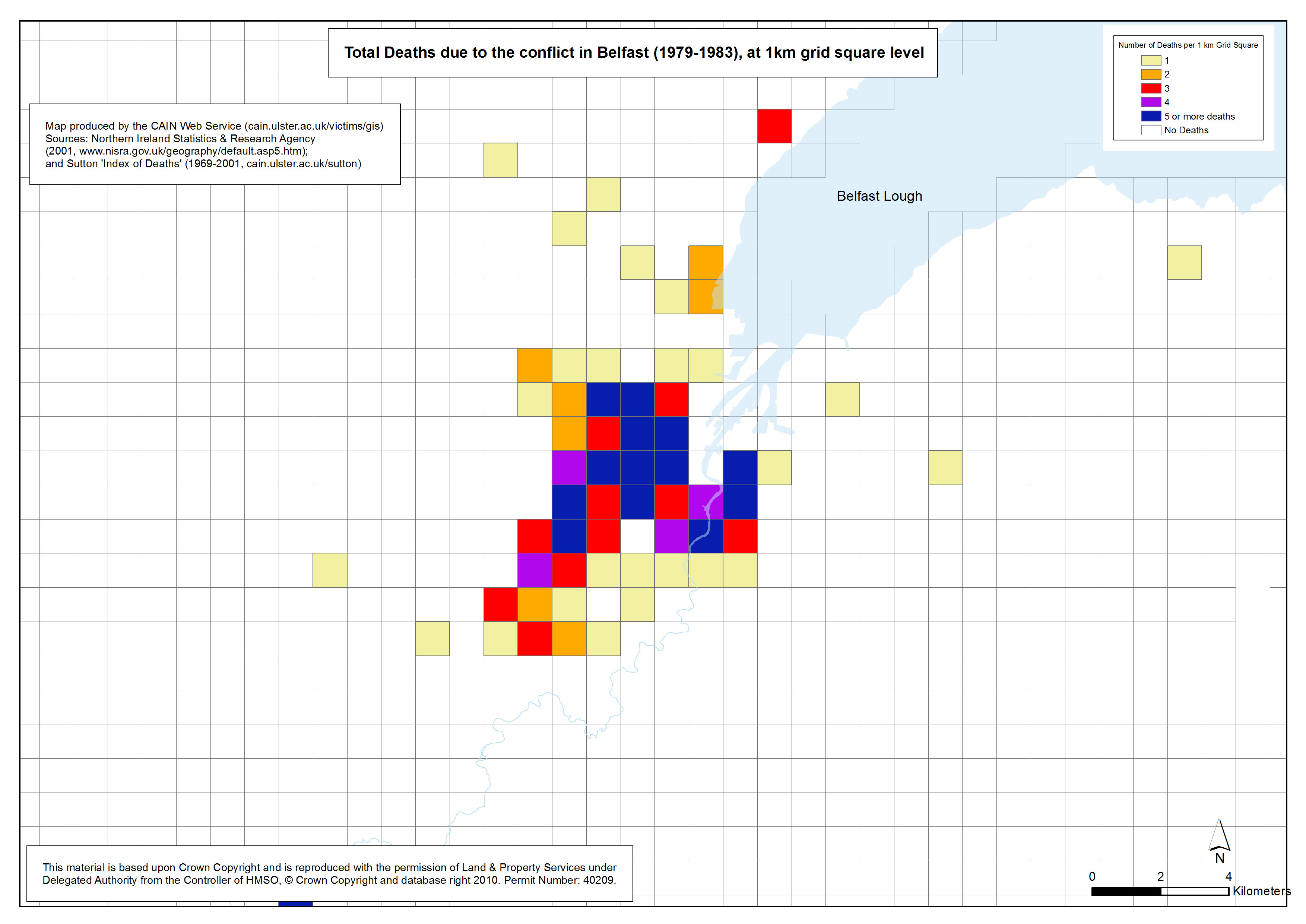
 Deaths - Belfast - 1979-1983 - 1km Grid Square Deaths - Belfast - 1979-1983 - 1km Grid Square
Total Deaths due to the conflict in Belfast (1979-1983), at 1km grid square level |
.pdf
467kb |
.jpg
132kb |
.jpg
811kb |
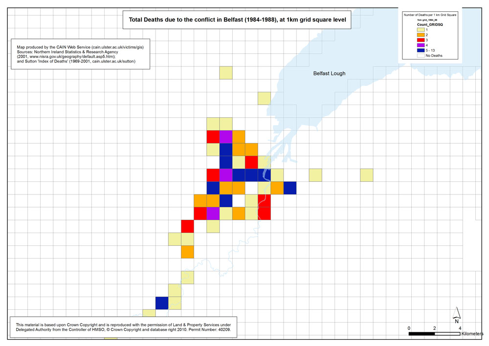
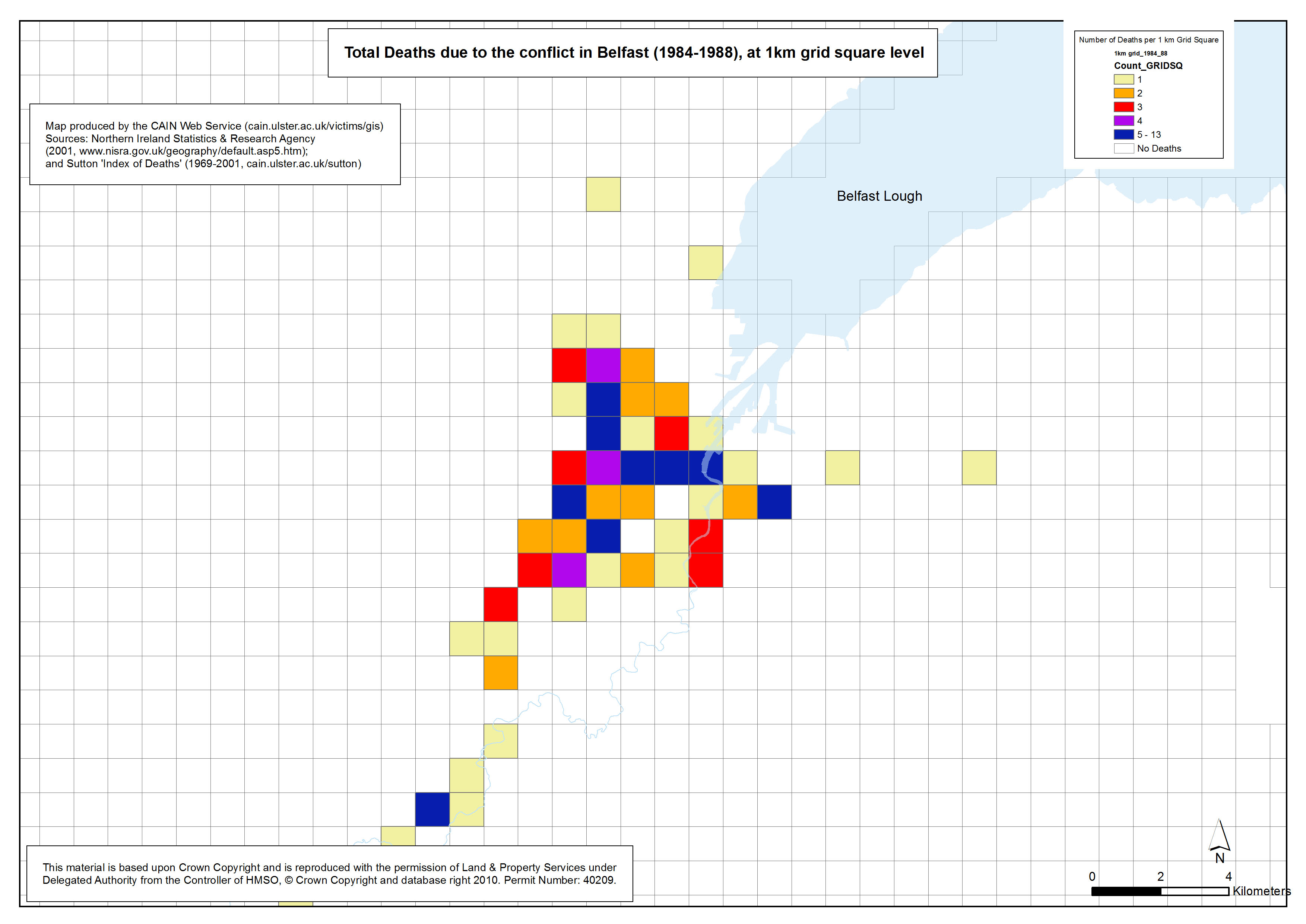
 Deaths - Belfast - 1984-1988 - 1km Grid Square Deaths - Belfast - 1984-1988 - 1km Grid Square
Total Deaths due to the conflict in Belfast (1984-1988), at 1km grid square level |
.pdf
466kb |
.jpg
131kb |
.jpg
810kb |
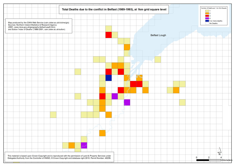
 Deaths - Belfast - 1989-1993 - 1km Grid Square Deaths - Belfast - 1989-1993 - 1km Grid Square
Total Deaths due to the conflict in Belfast (1989-1993), at 1km grid square level |
.pdf
470kb |
.jpg
133kb |
.jpg
818kb |
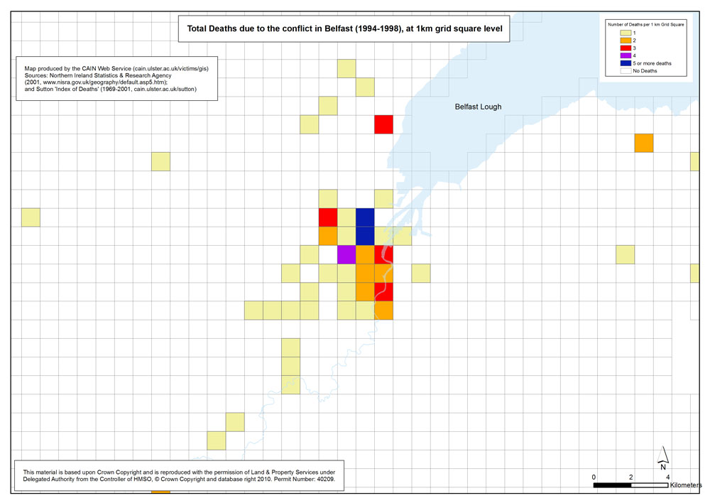
 Deaths - Belfast - 1994-1998 - 1km Grid Square Deaths - Belfast - 1994-1998 - 1km Grid Square
Total Deaths due to the conflict in Belfast (1994-1998), at 1km grid square level |
.pdf
466kb |
.jpg
129kb |
.jpg
806kb |
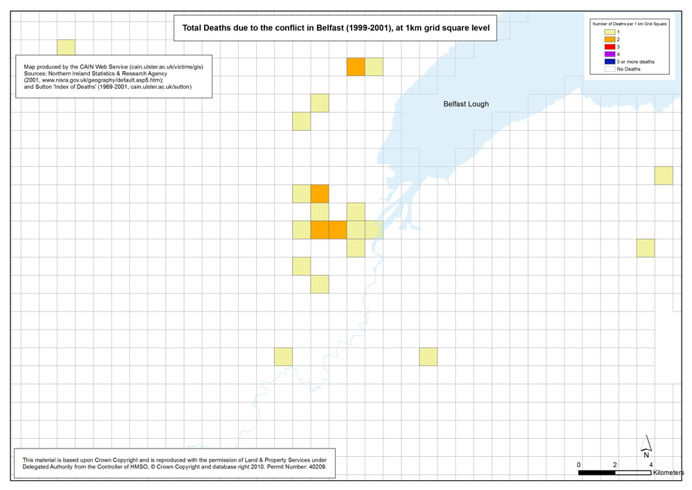
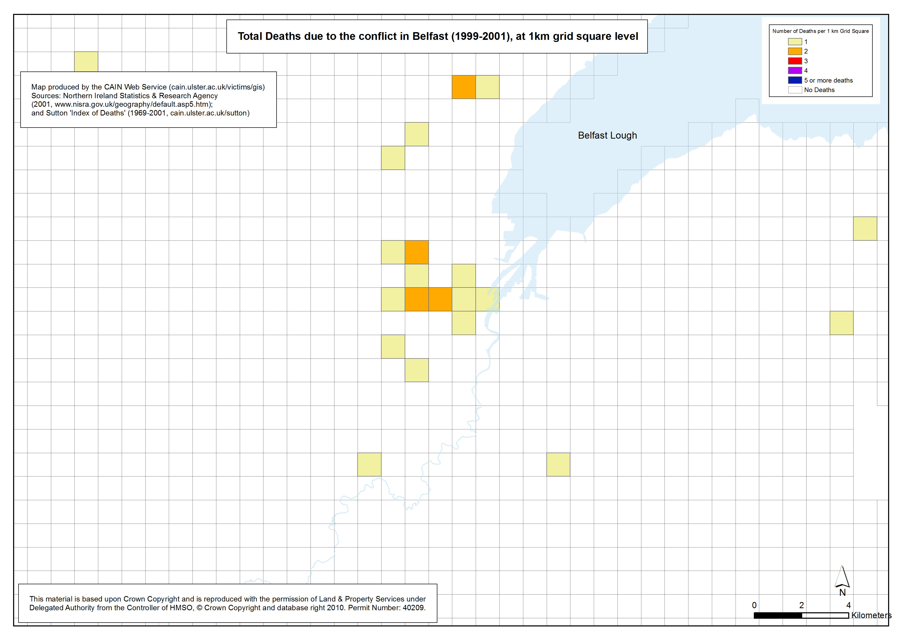
 Deaths - Belfast - 1999-2001 - 1km Grid Square Deaths - Belfast - 1999-2001 - 1km Grid Square
Total Deaths due to the conflict in Belfast (1999-2001), at 1km grid square level |
.pdf
462kb |
.jpg
125kb |
.jpg
793kb |
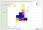
| Derry |
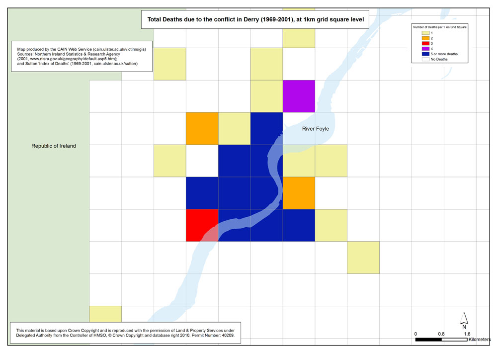
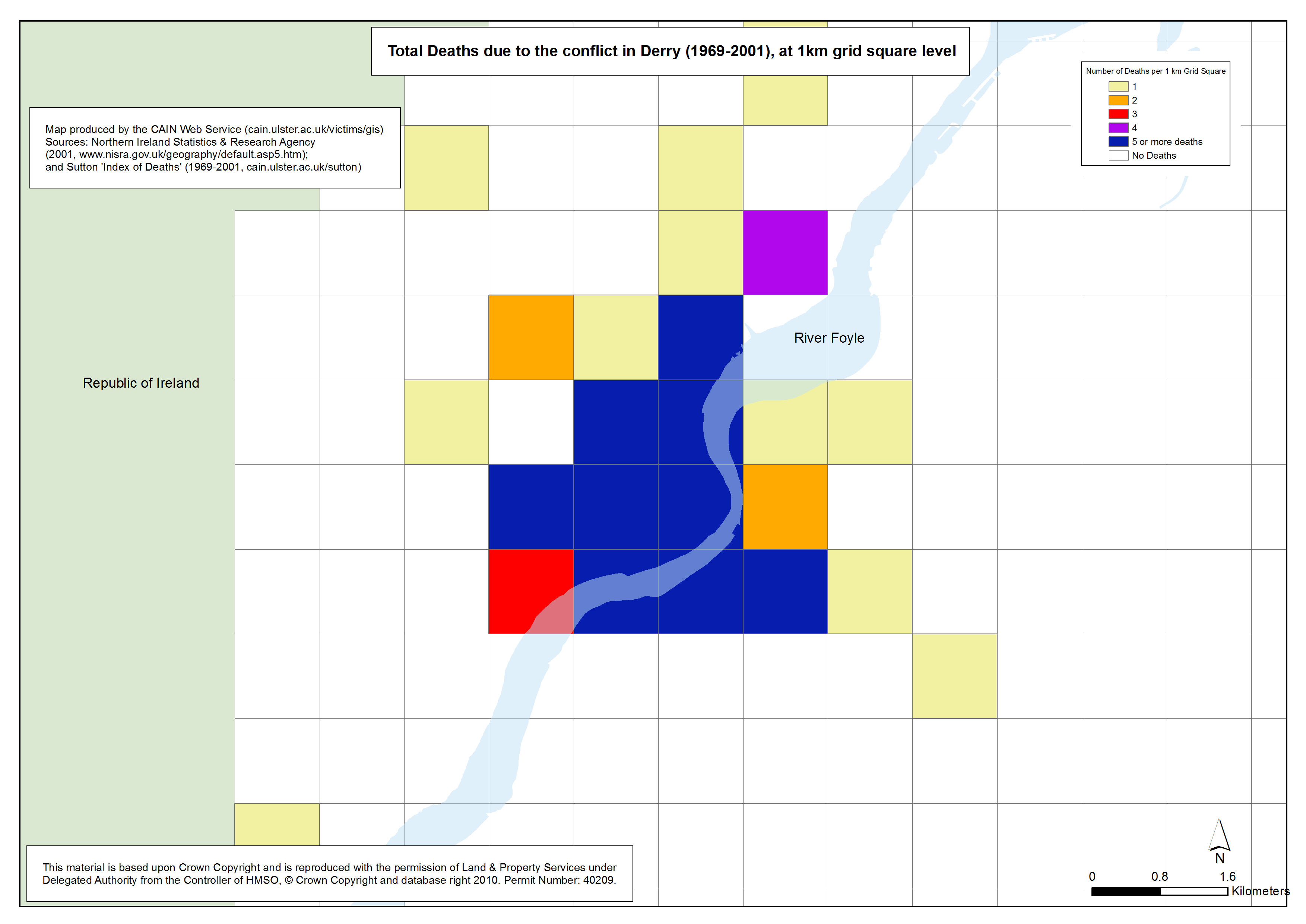
 Deaths - Derry - 1969-2001 - 1km Grid Square Deaths - Derry - 1969-2001 - 1km Grid Square
Total Deaths due to the conflict in Derry (1969-2001), at 1km grid square level |
.pdf
352kb |
.jpg
104kb |
.jpg
652kb |
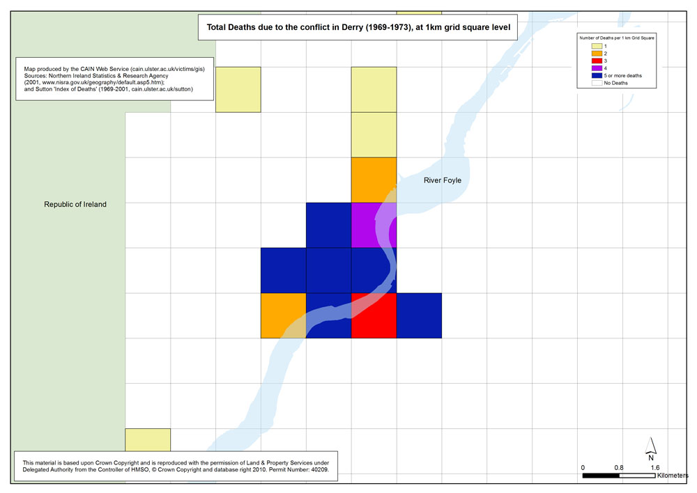
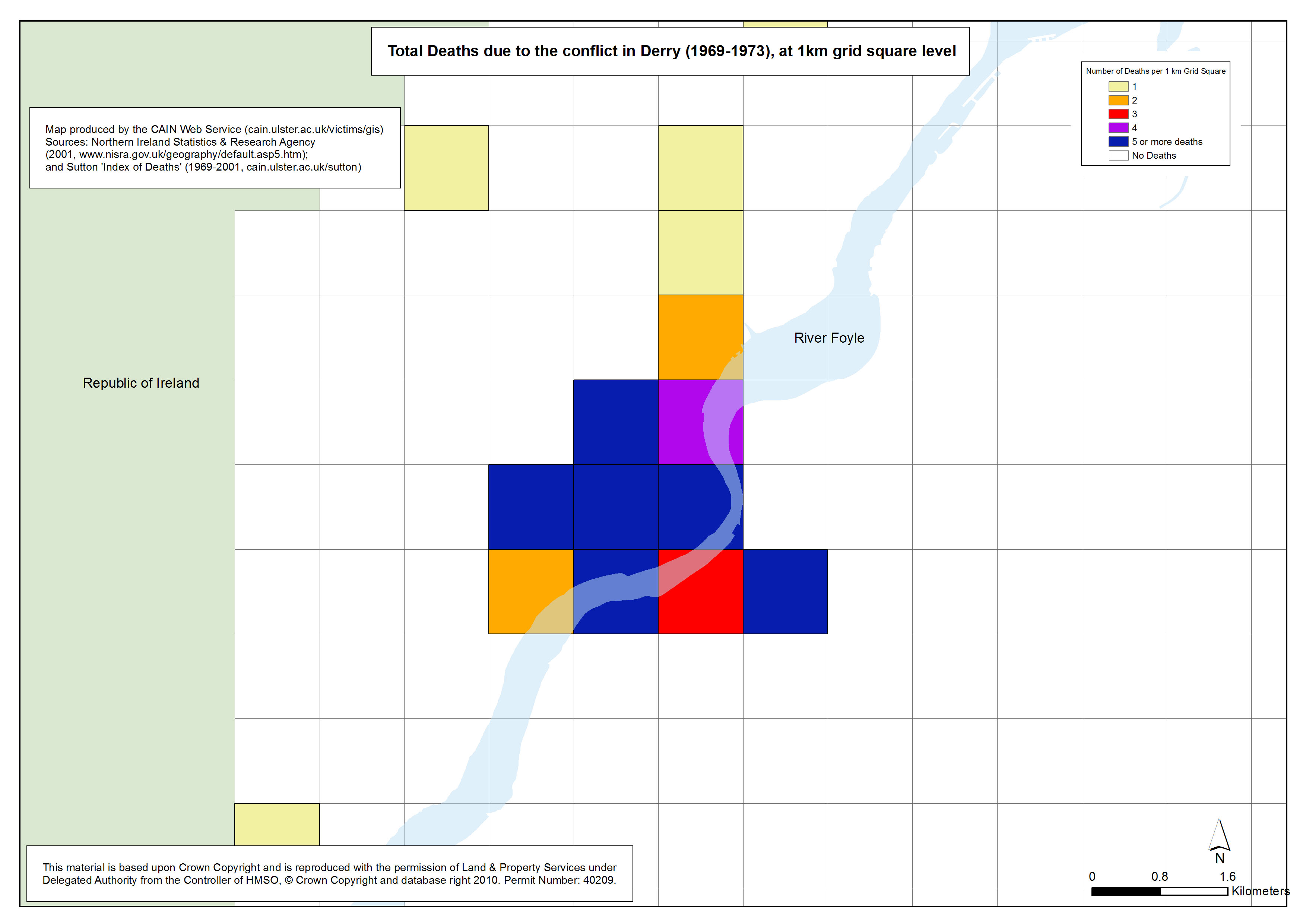
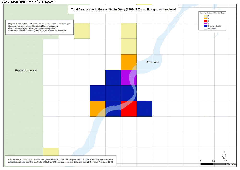
 Deaths - Derry - 1969-1973 - 1km Grid Square Deaths - Derry - 1969-1973 - 1km Grid Square
Total Deaths due to the conflict in Derry (1969-1973), at 1km grid square level |
.pdf
351kb |
.jpg
101kb |
.jpg
644kb |
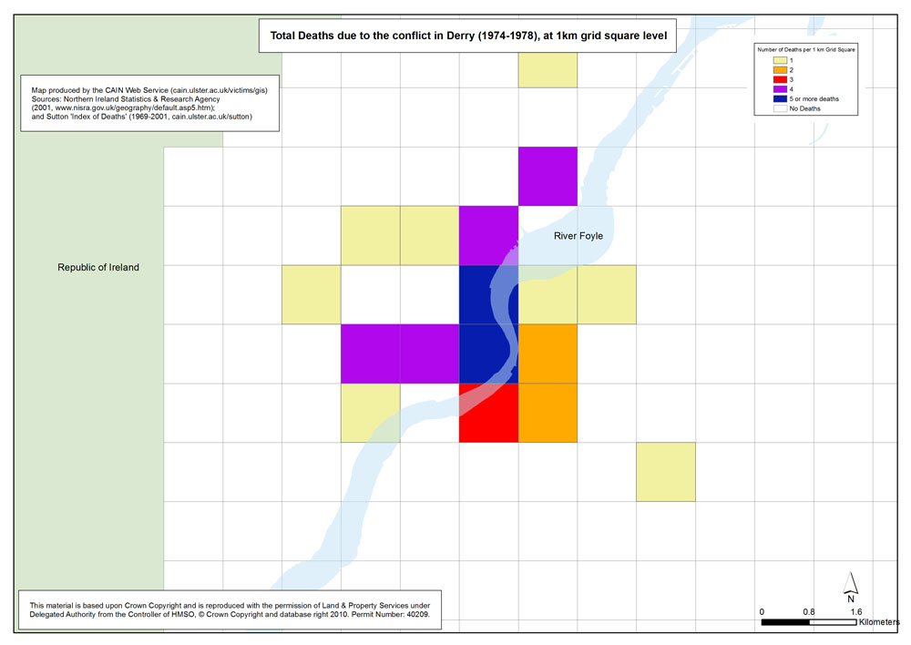
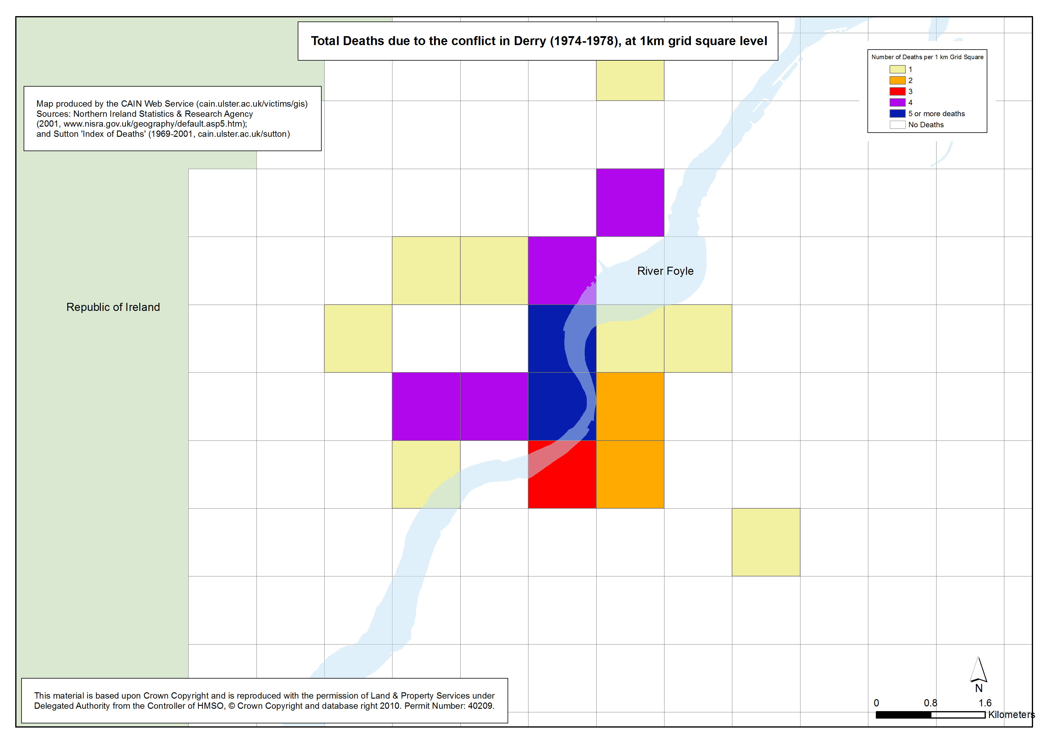
 Deaths - Derry - 1974-1978 - 1km Grid Square Deaths - Derry - 1974-1978 - 1km Grid Square
Total Deaths due to the conflict in Derry (1974-1978), at 1km grid square level |
.pdf
349kb |
.jpg
101kb |
.jpg
644kb |
 Deaths - Derry - 1979-1983 - 1km Grid Square Deaths - Derry - 1979-1983 - 1km Grid Square
Total Deaths due to the conflict in Derry (1979-1983), at 1km grid square level |
.pdf
348kb |
.jpg
100kb |
.jpg
642kb |
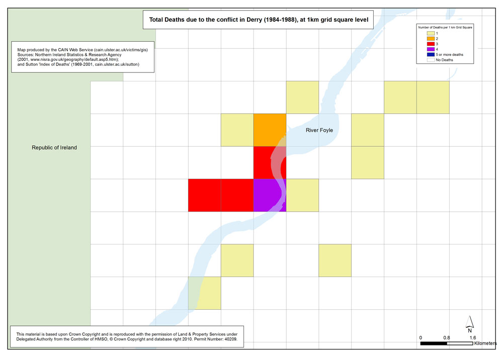
 Deaths - Derry - 1984-1988 - 1km Grid Square Deaths - Derry - 1984-1988 - 1km Grid Square
Total Deaths due to the conflict in Derry (1984-1988), at 1km grid square level |
.pdf
349kb |
.jpg
100kb |
.jpg
641kb |
 Deaths - Derry - 1989-1993 - 1km Grid Square Deaths - Derry - 1989-1993 - 1km Grid Square
Total Deaths due to the conflict in Derry (1989-1993), at 1km grid square level |
.pdf
344kb |
.jpg
96kb |
.jpg
627kb |
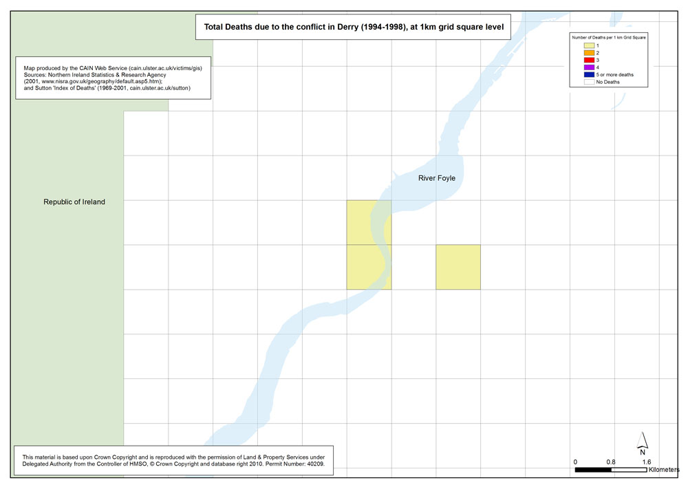
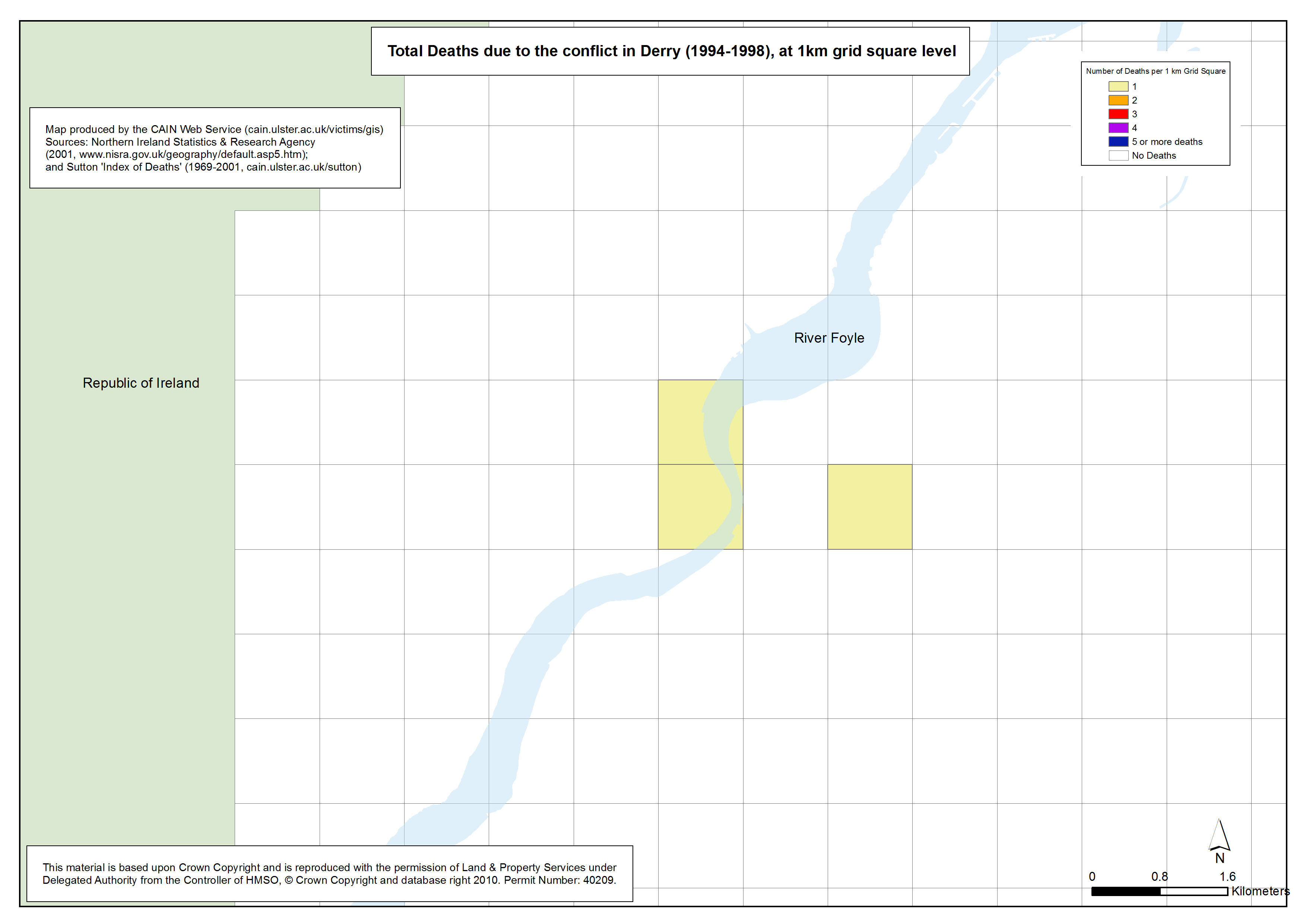
 Deaths - Derry - 1994-1998 - 1km Grid Square Deaths - Derry - 1994-1998 - 1km Grid Square
Total Deaths due to the conflict in Derry (1994-1998), at 1km grid square level |
.pdf
342kb |
.jpg
94kb |
.jpg
622kb |
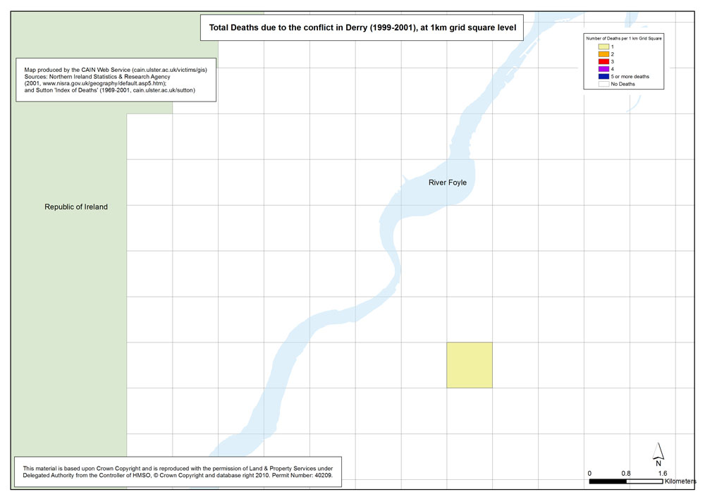
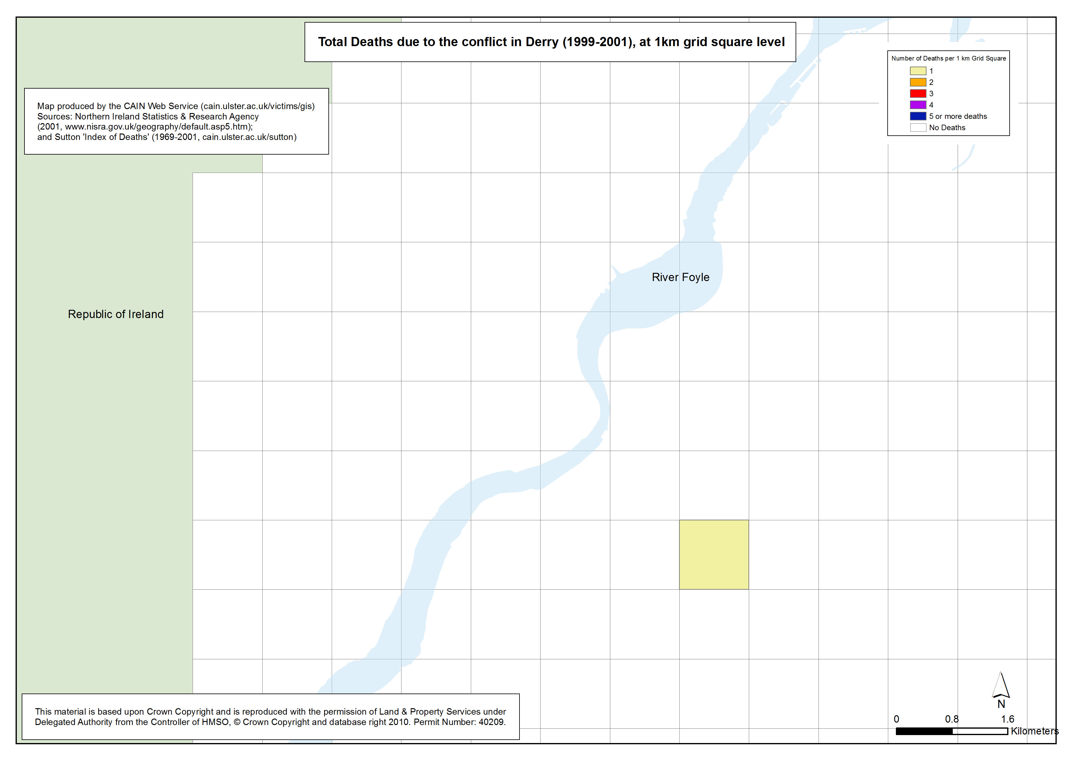
 Deaths - Derry - 1999-2001 - 1km Grid Square Deaths - Derry - 1999-2001 - 1km Grid Square
Total Deaths due to the conflict in Derry (1999-2001), at 1km grid square level |
.pdf
342kb |
.jpg
94kb |
.jpg
620kb |
| Animations - Deaths, by area (Northern Ireland, Belfast, Derry), by 5 year groups, at 1km grid square level (3 animations based on 21 maps) |
| Title of Animation |
File Version |
| GIF |
|
|
Animation - Deaths - NI - 1969-2001 - 1km Grid Square
Animated Gif of the above maps showing Total Deaths due to the conflict in Northern Ireland (1969-2001), at 1km grid square level. |
.gif
1392kb |
|
|
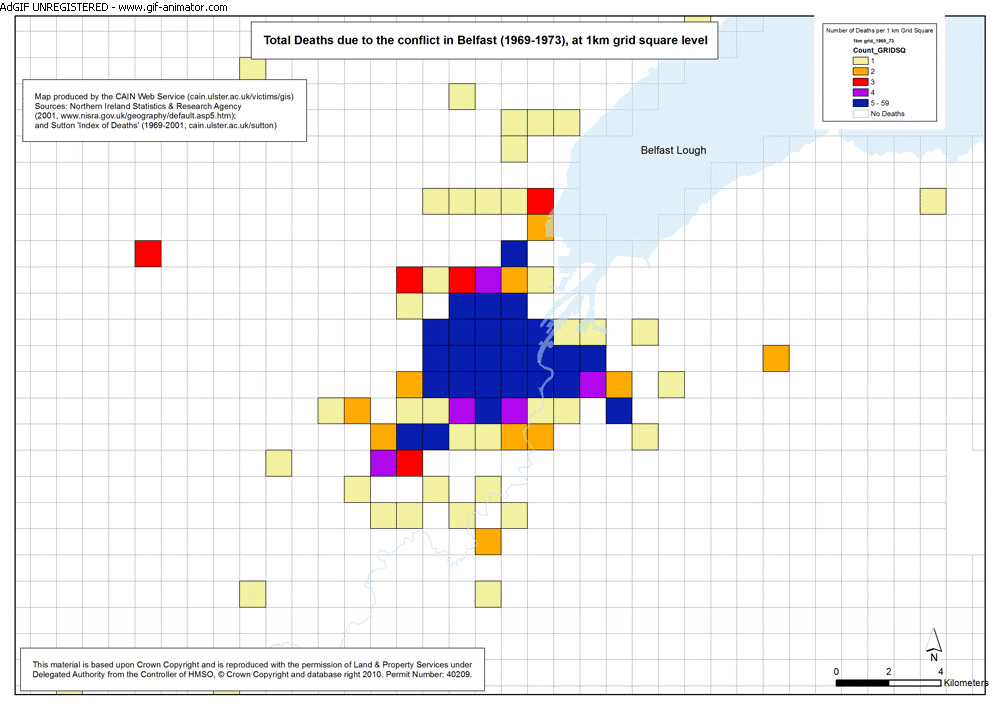
Animation - Deaths - Belfast - 1969-2001 - 1km Grid Square
Animated Gif of the above maps showing Total Deaths due to the conflict in Belfast (1969-2001), at 1km grid square level. |
.gif
926kb |
|
|
Animation - Deaths - Derry - 1969-2001 - 1km Grid Square
Animated Gif of the above maps showing Total Deaths due to the conflict in Derry (1969-2001), at 1km grid square level. |
.gif
604kb |
|
|
|
