'Remembering': Victims, Survivors and Commemoration
Physical Memorials - Google Map and Street View
map development by Julio Lopez Losada (2011) |
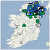
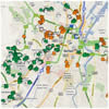
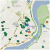
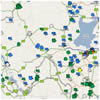
The following Google map contains overlaid information on physical memorials.
For a quick zoom click on one of the tabs at the top of the map. There is a legend below the map
which both explains the icons and can be used to select particular types of memorials to be
displayed on the map. Below the legend is the closest Street View to the memorial.
At the bottom of the page are some Additonal Notes about using the Google Map.
Select the view of the map you are interested in:
Ireland  Belfast  Derry  Middle Ulster 
Additional Notes:
- Rolling over the map icons displays basic information. It is then possible to click on an icon for further information.
- In the case of a single memorial rolling over an icon will show: a thumbnail photograph if available; the name of the memorial; and the address. If the user then clicks on the icon the information about the memorial contained in the CAIN database is displayed in a new browser window.
- Where two or more memorials are sited at exactly the same location (e.g., a plaque attached to a mural) then a list appears when a users rolls over the icons. The user then has a first option to click on one of the items on the list to get further information. Alternatively, the second option is to click on the icon and information for each item on the list will appear in separate windows.
- Where two or more memorials are sited closely together but not in the exact same location, and they have been given separate location coordinates, the icons will sit one on top of the other. Zooming to the largest scale may help to resolve the icons.
|

