
|
|
|
|
|
|
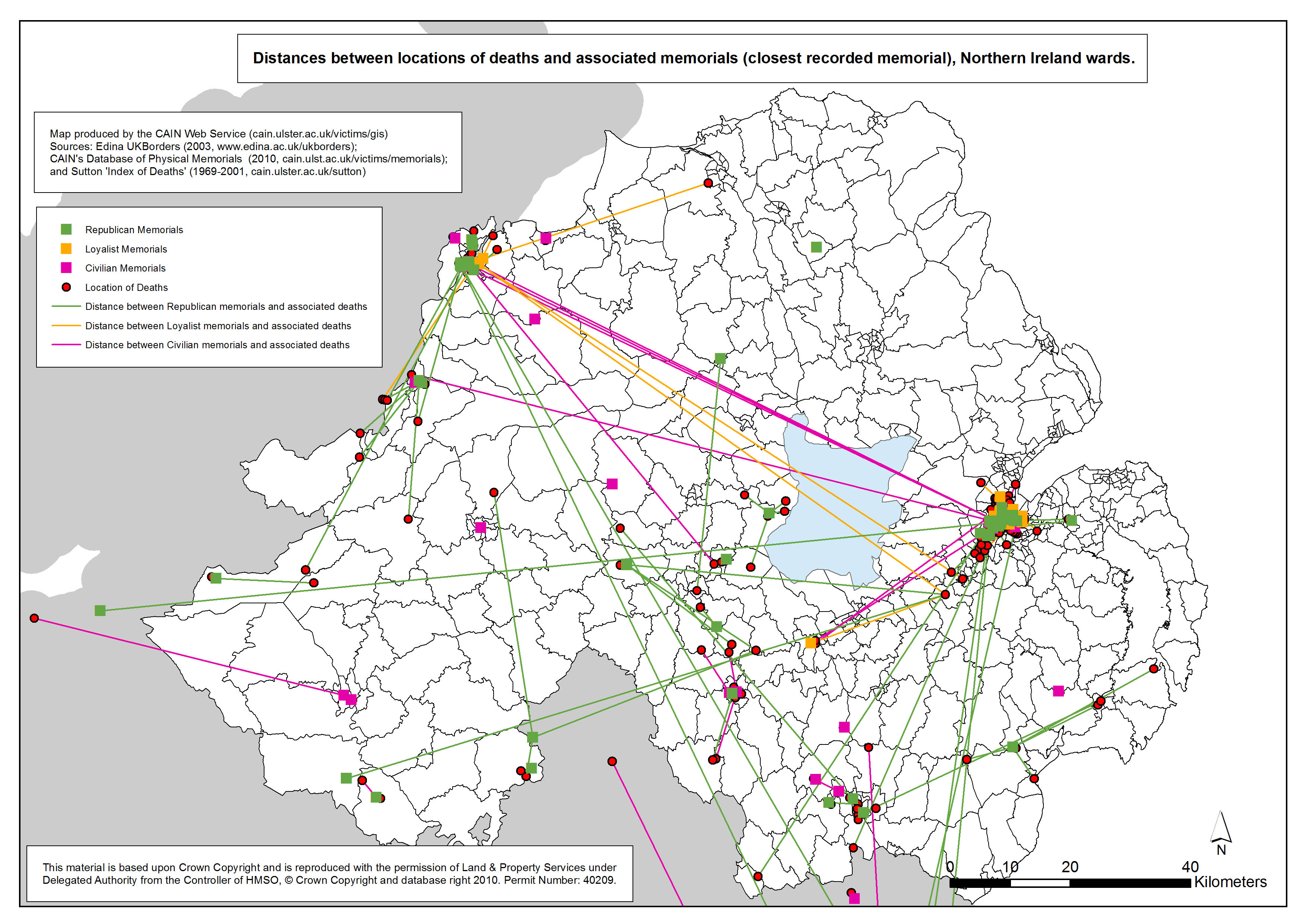
The information used to locate and plot each death is contained within Malcolm Sutton’s 'Index of Deaths 1969-2001'. The information used to locate and plot each memorial is provided by CAIN’s Database of Physical Memorials to the conflict in Northern Ireland. Memorials in the CAIN database were grouped into four main categories: Civilian; Republican; Loyalist; and British Security Force. It was known in advance of the research that most British Security force monuments are located within army bases, police stations, Protestant churches, Loyal Order halls, and other buildings. Due to issues related to gaining access to such buildings, a comprehensive survey of Security Force memorials could not be undertaken. Some have been included, mainly those few to be found in public spaces and several in Protestant churches. However, for the purpose of the analysis of distance information this group was omitted from the analysis. Three geographical areas have been mapped for each of these categories: Belfast, Derry, and Northern Ireland. The data is mapped at electoral ward level. There are 582 electoral wards in Northern Ireland as defined by the Boundary Commission for Northern Ireland in 1995. There are two graphs associated with this set of maps. The graphs are box plots which were calculated to summarise all the information about the distances between location of deaths and associated memorials.
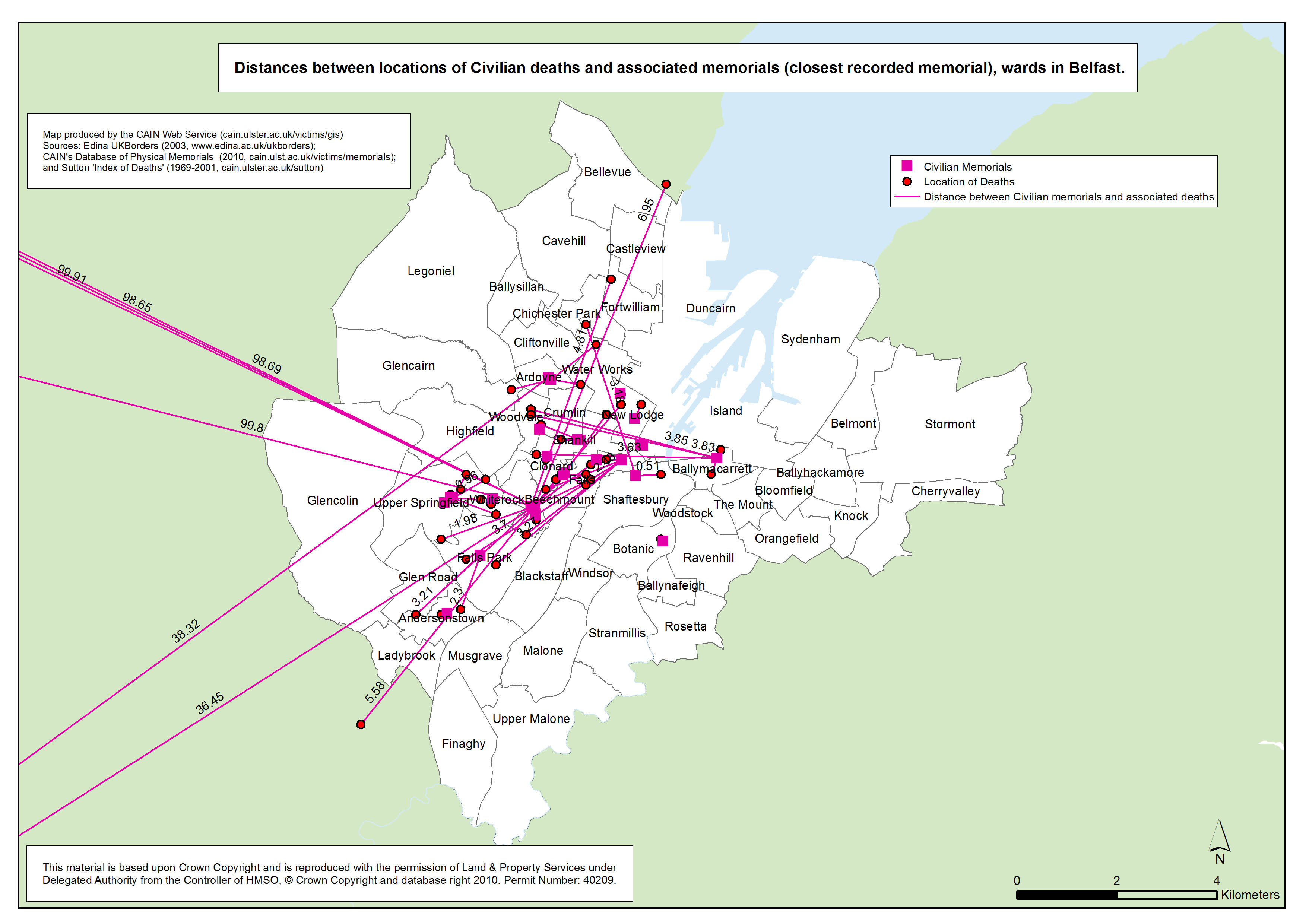
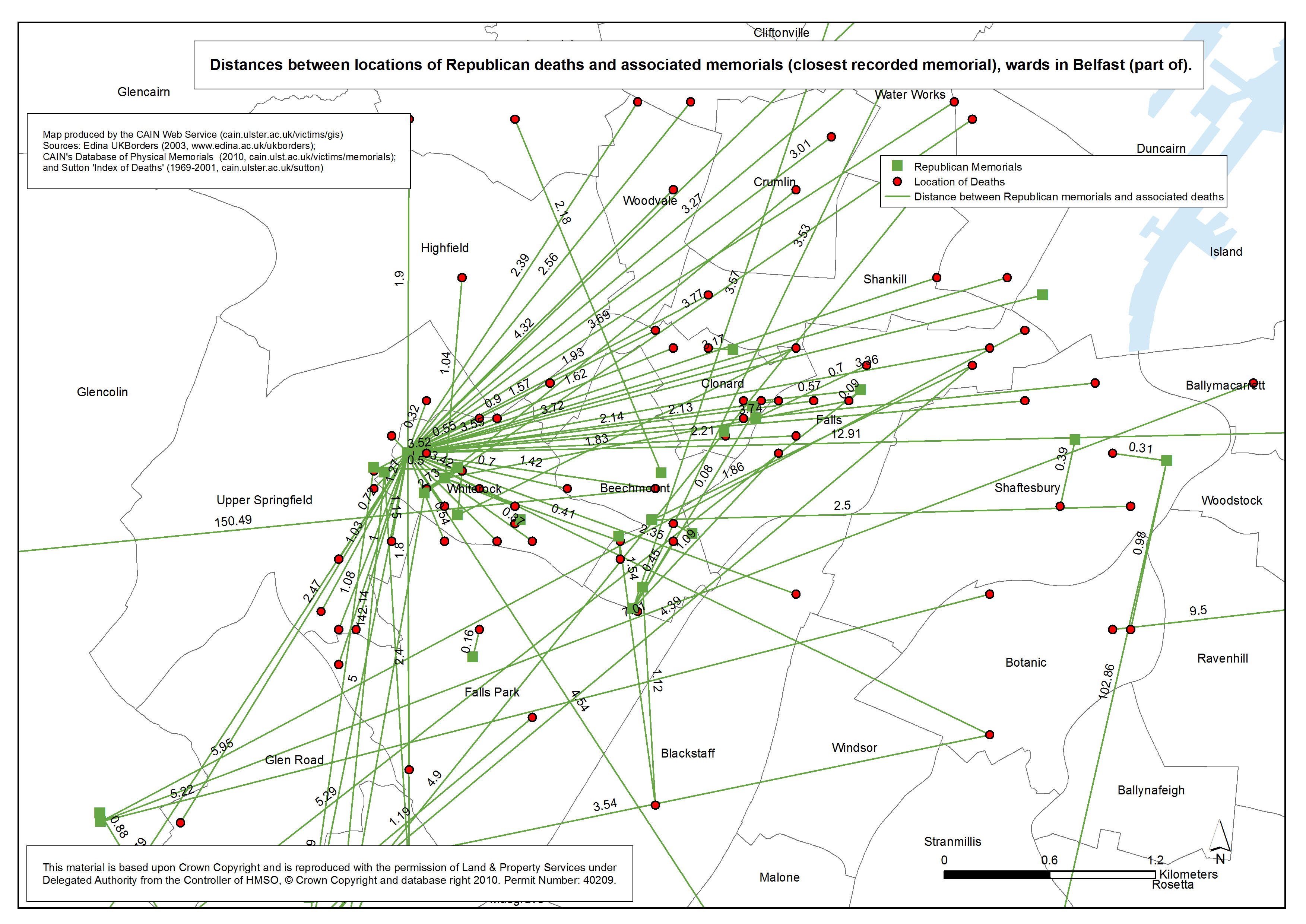
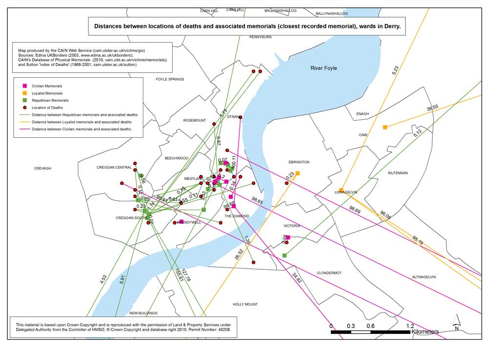
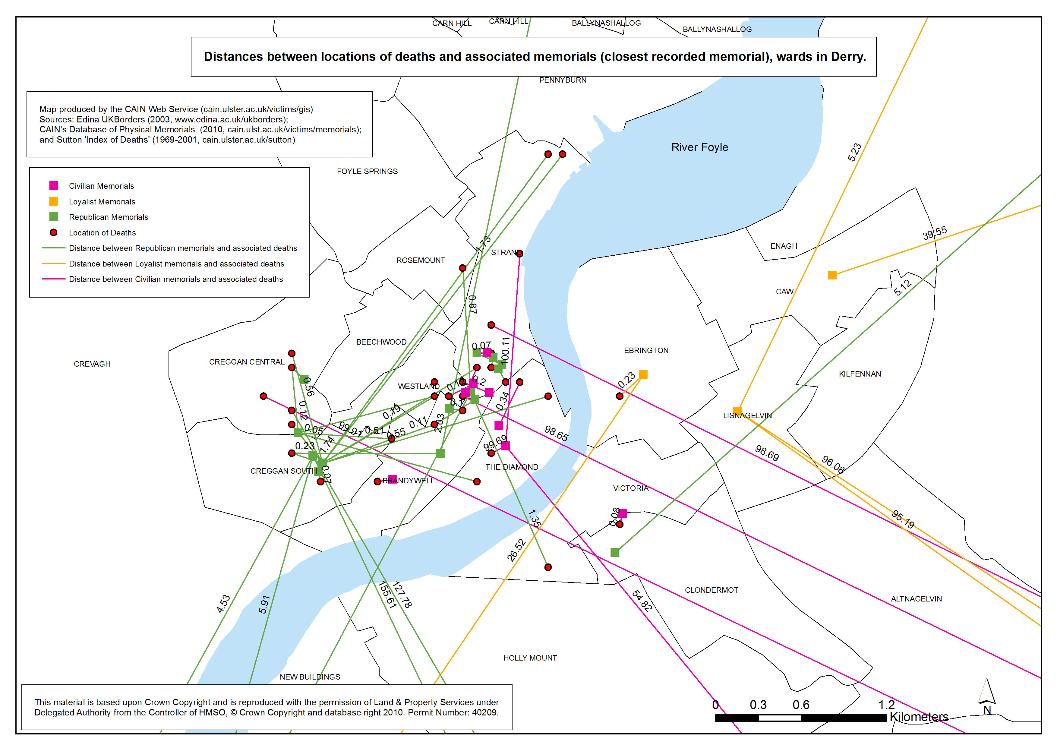
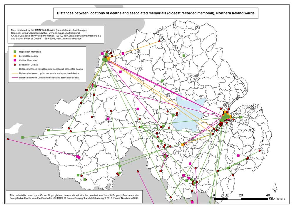
The availability of two databases, one containing the map co-ordinates for physical memorials and the other containing co-ordinates for the location of deaths, provided an opportunity to look at the relationship between the location of memorials and the location of deaths. When the fieldwork to collect the information on physical memorials in public spaces was carried out (2007-09) it was clear that some memorials were sited very close to the place were the person had been killed. It was also possible to discern differences in the way that various individuals, groups, and organisations placed memorials in public spaces. However, it was not possible to draw any firm conclusions based on the visits to memorial sites. What was needed was an analysis of the information collected at each memorial site. In looking at the information it was decided to categorise memorials into four broad groups: civilian, Loyalist paramilitary, Republican paramilitary, and British security. Researchers were aware that there were relatively few British security memorials in public spaces in Northern Ireland. This was confirmed by the fieldwork although the number probably has increased in recent years. However, for the purpose of the analysis the number of memorials located in public spaces was small, and given the lack of information on memorials inside security force bases and police stations, it was decided to drop this category from the analysis. So for civilian, Loyalist paramilitary, and Republican paramilitary memorials maps were drawn (see maps above) with the distances displayed between the memorials and the location of the persons commemorated. Where a person was commemorated on more than one memorial then the closest memorial was chosen to provide the distance measurement. An examination of the maps (in particular the full scalable GIS maps which can not be reproduced above) indicated that there were likely to be differences in the average distances between locations of deaths and memorials for the three groups. To confirm this it was necessary to compare the distances for the three groups using box plots (or box-and-whisker diagrams). These are available on separate Web page. The box plots depict the smallest distance (represented by the lower horizontal line / the bottom whisker), the lower quartile (the lower section of the box), the median (an average figure represented by the horizontal line through the box), the upper quartile (the upper section of the box), and the greatest distance (the upper horizontal line / the top whisker). The box plots also display points outside the whiskers which may be considered outliers. Two box plot graphs/diagrams are provided. One which set a 10 kilometre limit and one which set a 20 kilometre limit on the analysis. These limits were set to try to retain some detail in the box plots. Both box plots indicate that there are differences between the three categories of memorials. Civilian memorials are placed, on average, closer to the place where the person commemorated was killed. There is a much wider spread of distances for Loyalist paramilitary memorials. The spread for Republican paramilitary memorials is wider still. There are two explanations for the observed differences in distances. The first relates to the distinction between civilian and paramilitary. Paramilitary groups by their nature have an organisational structure and when it comes to commemoration they tend to use particular memorial sites, such as memorial gardens to commemorate all their members who were killed in the conflict. Civilians are less likely to be part of a group, except in those situations where a large number of people were killed during a particular incident. As individuals they are more likely to be commemorated close to the spot were they were killed. There are probably fewer restraints, or political opposition, to civilians installing a memorial (say a plaque) in a public space close to where a relative was killed. It is also the case that civilian memorials are not subject to the same level of orchestrated attack as paramilitary memorials. The second explanation refers to paramilitary groups and helps to explain the observed difference between Loyalist and Republican. According to Sutton's Index of Deaths, of the 1016 people killed by Loyalist paramilitaries, 868 (85.4%) were civilians, that is people not able to 'return fire', and 41 (4.0%) were Republican paramilitaries. Of the 168 Loyalist paramilitaries who were killed, 93 (55.4%) were killed by other Loyalist paramilitaries (mainly in feuds and disputes). So while Loyalist paramilitaries ranged far and wide when they were killing other people, they tended to be killed themselves in their 'own areas'. Hence their memorials are sited closer to the locations where they died. Of the 2060 people killed by Republican paramilitaries, 1080 (52.4%) were British security and 727 (35.3%) were civilians. Of the 395 Republican paramilitaries who were killed, 187 (47.3%) were killed by other Republicans (although many occurred in accidental explosions when transporting bombs). Republican paramilitaries had a deliberate policy of extending the geographical range of their 'armed campaign' in order to stretch the resources of the security forces. Inevitably many Republicans were killed far from their 'base areas'. Hence their memorials are sited at a greater distance from the locations where they died. In Derry, on Rossville Street in the Bogside, the Derry Republican Graves Association has placed a monument to IRA members killed in the city. The inscription on one side reads:
The 'circumstances' referred to in the inscription are the likely public outcry against, and the probable destruction of, any Republican memorials that appeared for example in the city centre or in 'Loyalist areas'. If it had been possible, in more cases, for the Republican Movement to mark the exact spots where IRA members died, then this would have be reflected in the box plots discussed above.
The information used to locate and plot each death is contained within Malcolm Sutton’s 'Index of Deaths 1969-2001': The information used to locate and plot each memorial is provided by CAIN’s Database of Physical Memorials to the conflict in Northern Ireland: The data is mapped at electoral ward level. There are 582 electoral wards in Northern Ireland as defined by the Boundary Commission for Northern Ireland in 1995. The electoral ward shapefile was downloaded from EDINA borders website. See also: Boxplot graphs associated with the above maps:
The GIS maps listed above have been produced as part of the AHRC 'Visualising the Conflict' Project. The maps have been reproduced and made available with the permission of Land & Property Services under Delegated Authority from the Controller of HMSO, © Crown Copyright and database right 2010; Permit Number: 40209. All maps were prepared by Luke Kelleher, then a Research Associate (GIS) working with CAIN. All maps were sized A4 (approximately). GIS software was used to produce TIFF versions (A4 approx; 300dpi) which are available on request. Three versions of each map have been made available above:
It proved very difficult to display the mapping information on the distances between locations of deaths and memorials simply because of the amount of detail in the GIS files. It would require a large scale map to view the details of memorials that are sited very close to the location of deaths, but this makes viewing a larger area impracticable. Similarly a small scale map allows one to view a larger area but then the detail is lost. In the case of Belfast, an attempt was made to proivde both views by showing all of Belfast and then a central part of the city on two separate maps.
|
|||||||||||||||||||||||||||||||||||||||||||||
|
Last modified:
January 19, 2012 22:47
|
||
|
|
||
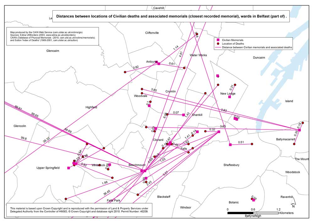
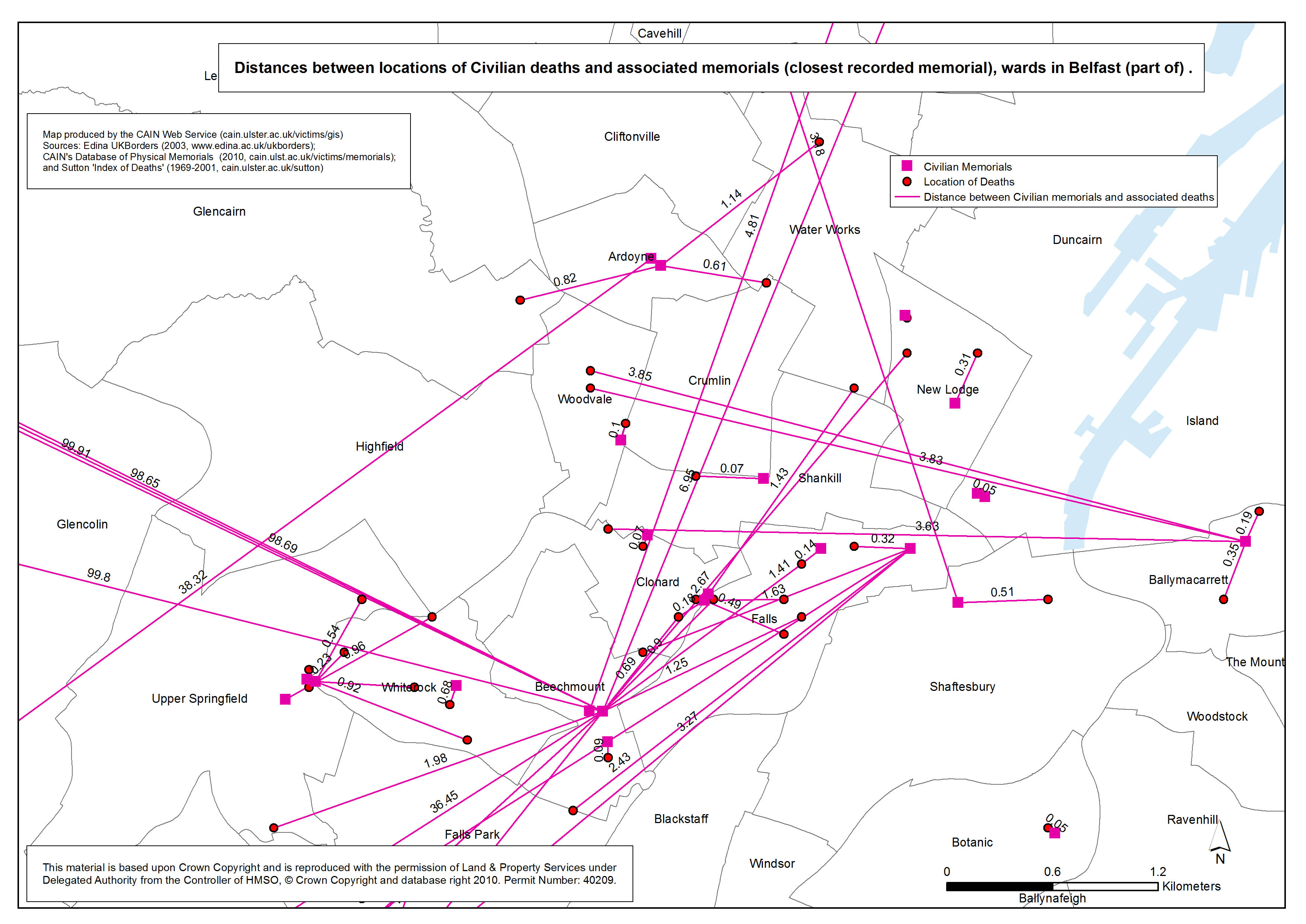
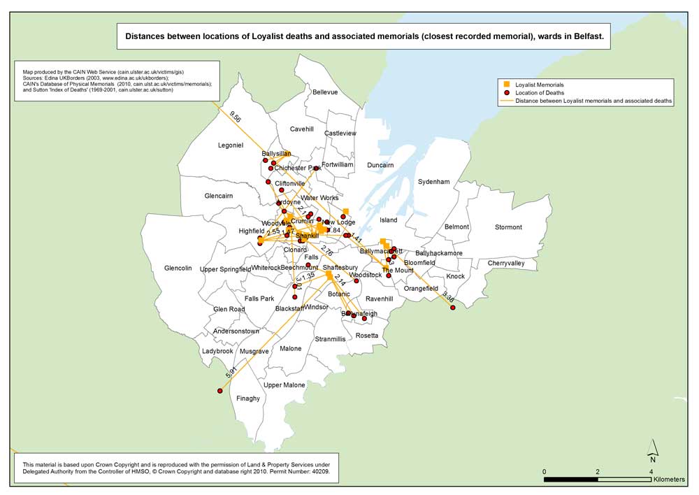
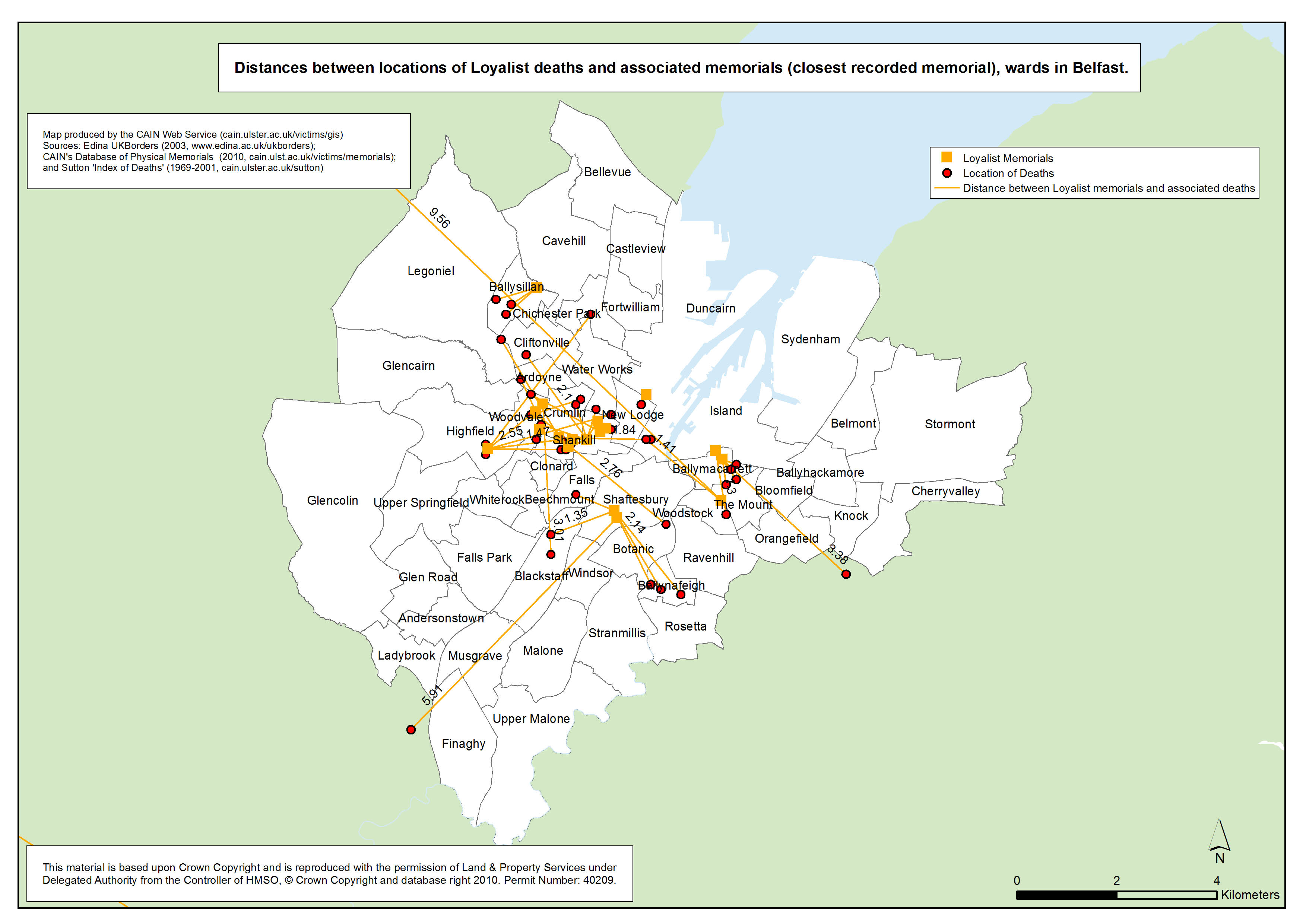
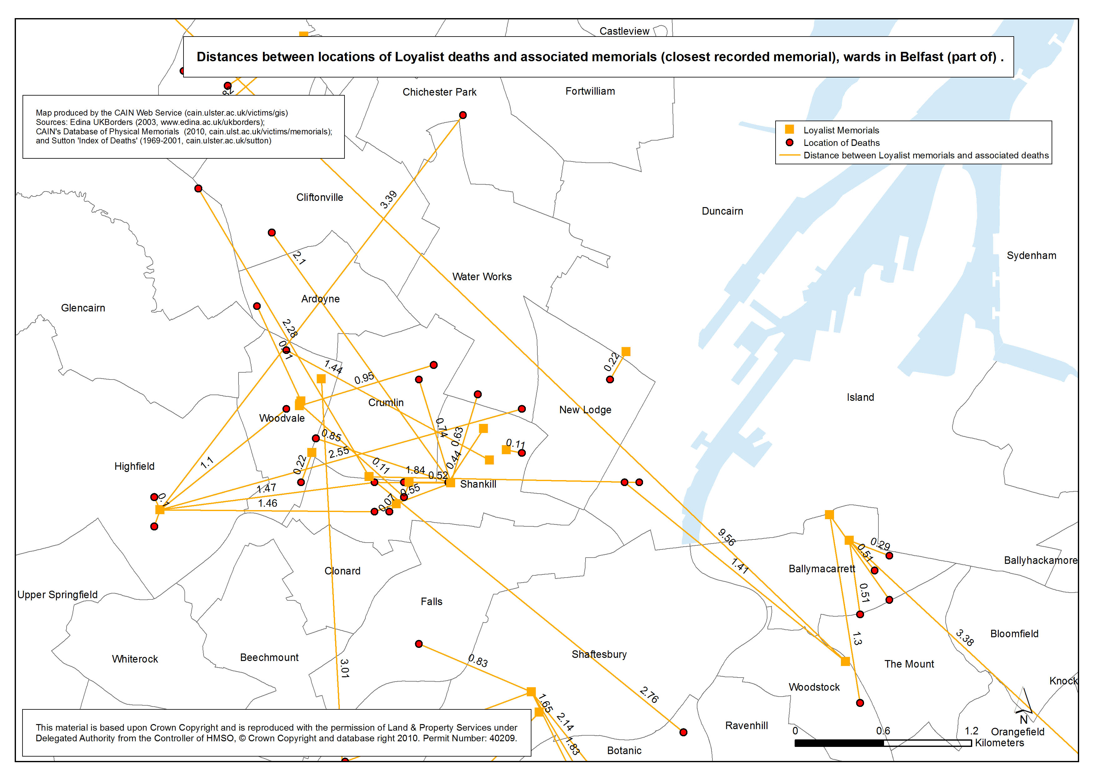
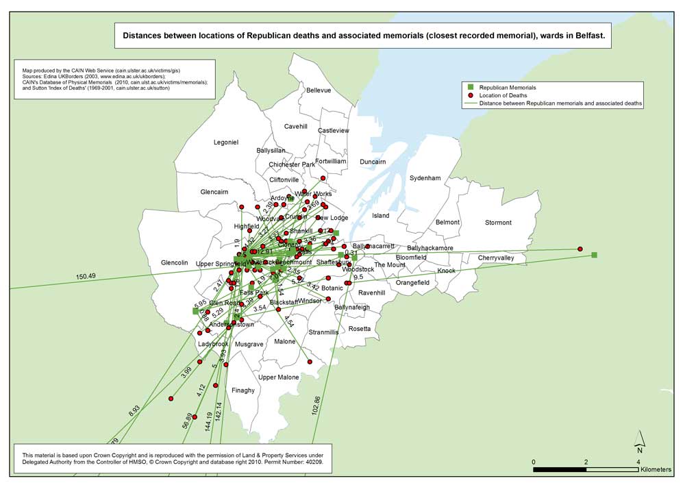
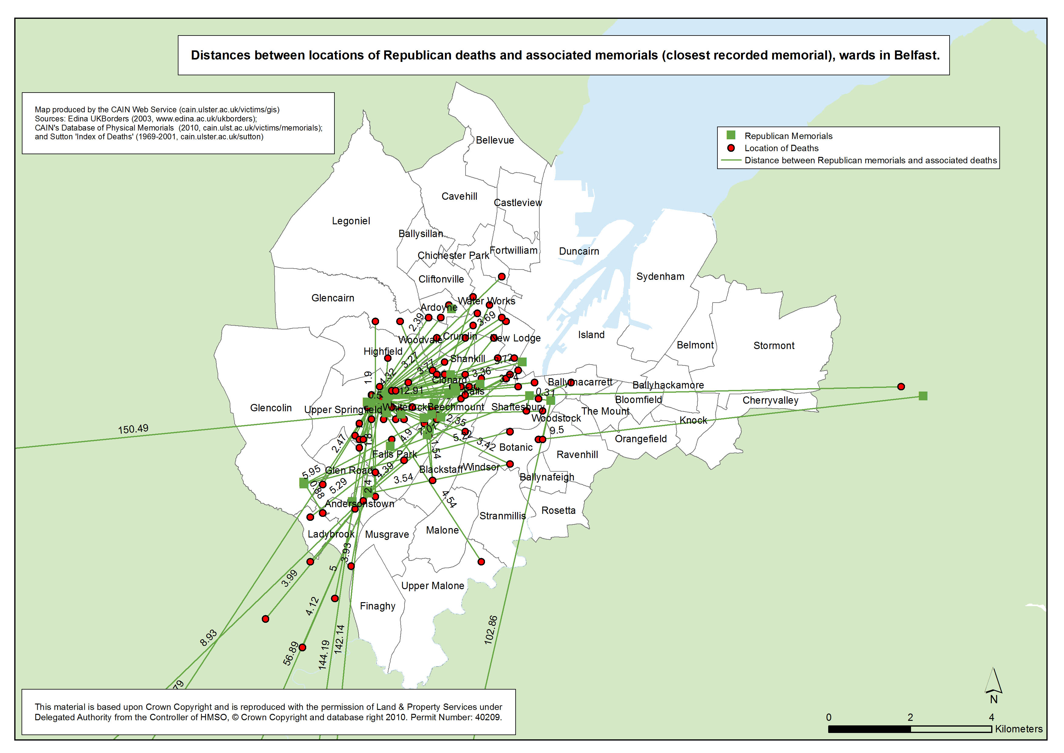
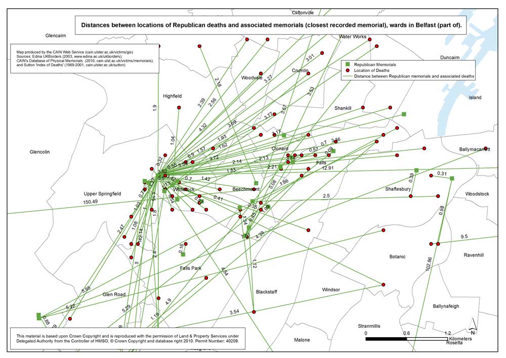
 Utilising the Sutton Index of Deaths and the CAIN database of memorials, an analysis was conducted of the distance between the location where a person was killed and the closest memorial that commemorates that individual. In examining the relationship between place of death and place of commemoration it was decided to use the closest memorial where more than one memorial was known to exist. The maps below show the location of death, location of the nearest associated memorial and the straight line distance between the two points.
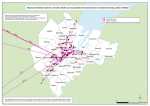 Distances - Civilian - Belfast
 Distances - Loyalist - Belfast
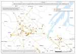 Distances - Loyalist - Belfast (part of)
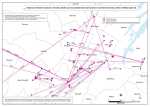
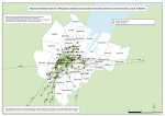 Distances - Republican - Belfast
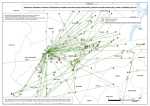 Distances - Republican - Belfast (part of)
 Distances - Civilian, Loyalist, Republican - Derry
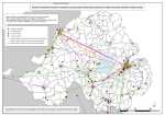 Distances - Civilian, Loyalist, Republican - Northern Ireland
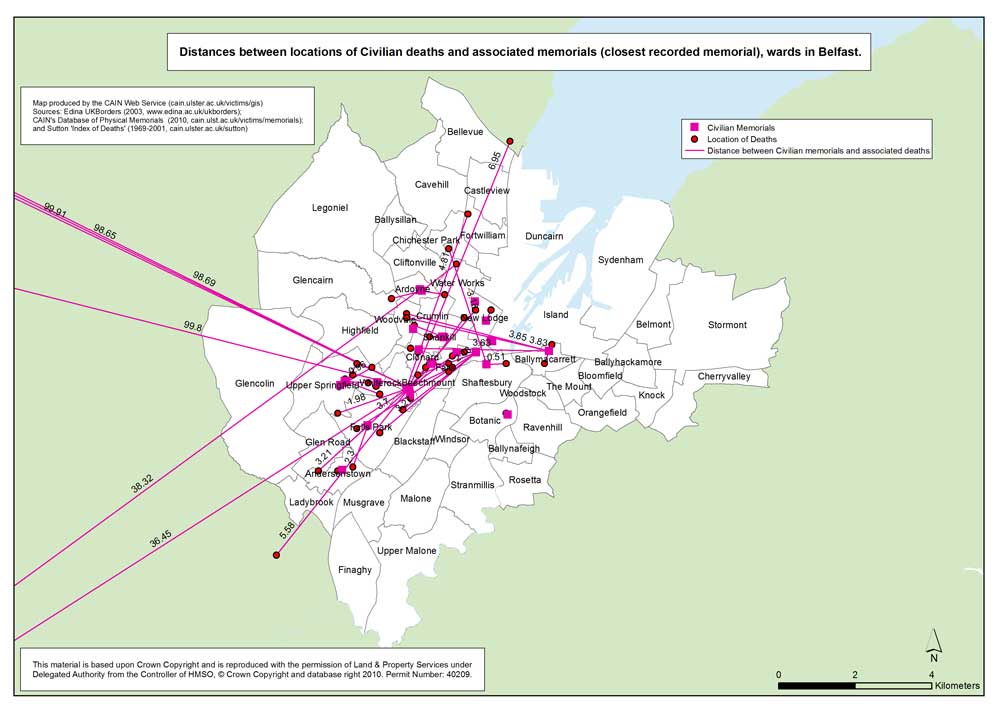