Visualising the Conflict
Geographic Information Systems (GIS) Maps
Map Set 11:
Deaths by Year |
| Map Set 11: Deaths by Year - Introduction |
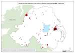
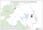
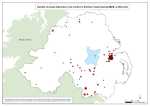
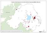
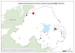
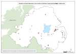
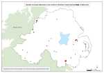
Number of people killed due to the conflict in Northern Ireland, by year (1969-2001), at SOA (Small Output Area)
34 maps
See also:
Animation of above maps
1 animation
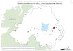
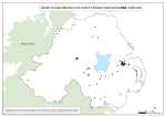
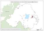
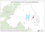
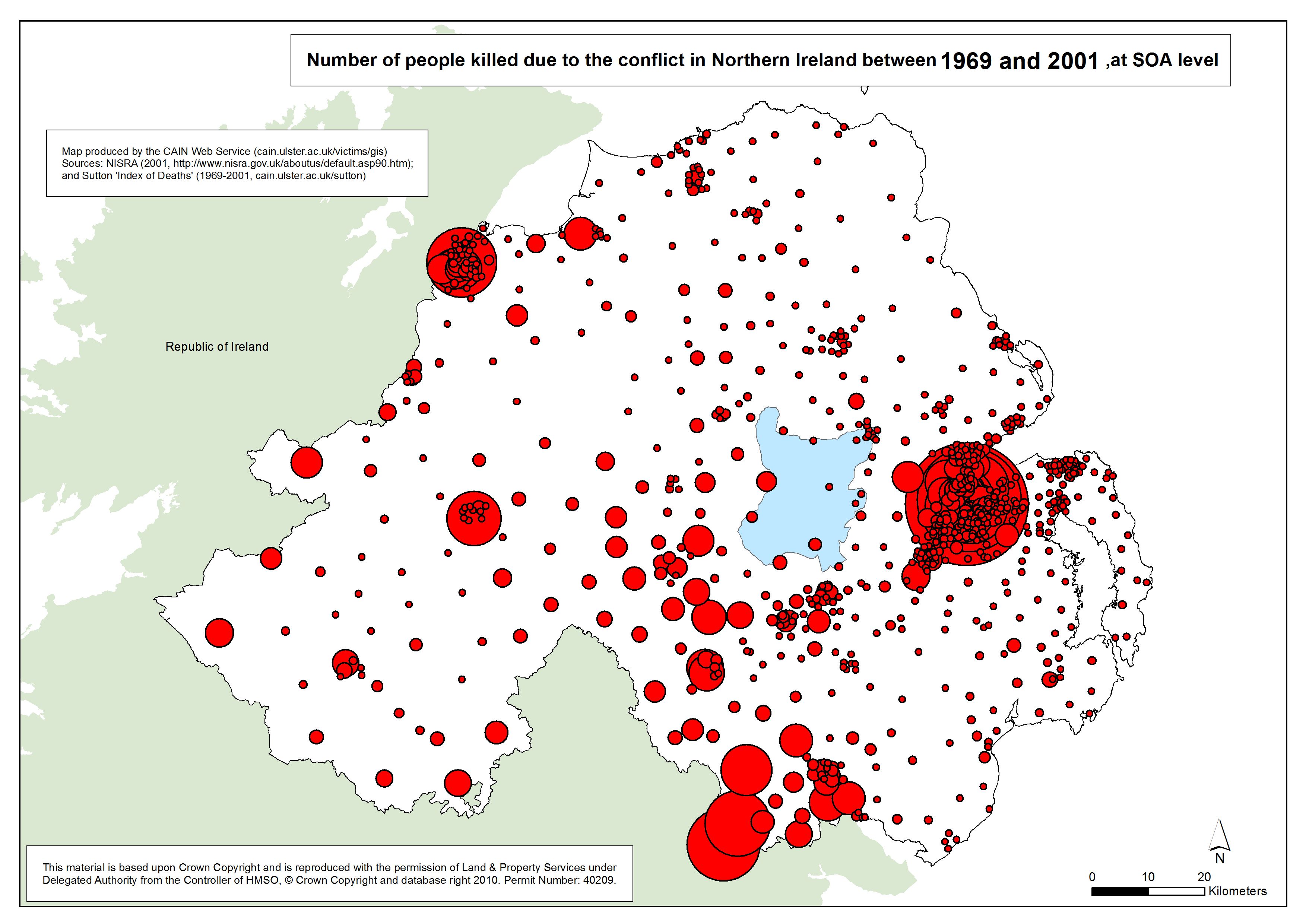
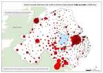 This set of maps illustrates the number of people killed due to the conflict in Northern Ireland. The data is mapped at Super Output Area (SOA) level and shows not only the total number of deaths between 1969 and 2001 but also provides a breakdown on an annual basis for each year of the Troubles (1969-2001). The information used to locate and plot each death is provided by Malcolm Sutton’s “Index of Deaths 1969-2001” (http://www.cain.ulster.ac.uk/sutton/). This set of maps illustrates the number of people killed due to the conflict in Northern Ireland. The data is mapped at Super Output Area (SOA) level and shows not only the total number of deaths between 1969 and 2001 but also provides a breakdown on an annual basis for each year of the Troubles (1969-2001). The information used to locate and plot each death is provided by Malcolm Sutton’s “Index of Deaths 1969-2001” (http://www.cain.ulster.ac.uk/sutton/).
SOAs have been created on a ward-by-ward basis taking into account measures of population size and mutual proximity. The target size for SOAs is approximately 2000. In total there are 890 SOAs in Northern Ireland. The maps employ a proportional symbol indicator whereby the greater the number of deaths within each SOA the larger the red symbol. In addition to the static maps, a further dimension is provided by an animated version of the data. The SOA shapefiles were downloaded from the Northern Ireland Statistics and Research Agency.
(http://www.nisra.gov.uk/deprivation/super_output_areas.htm).
| Maps - Number of people killed due to the conflict in Northern Ireland, by year (1969-2001), at SOA (Small Output Area) (34 maps compiled and drawn by Luke Kelleher) |
| Title of Map |
File Version |
| PDF |
L-JPG |
H-JPG |
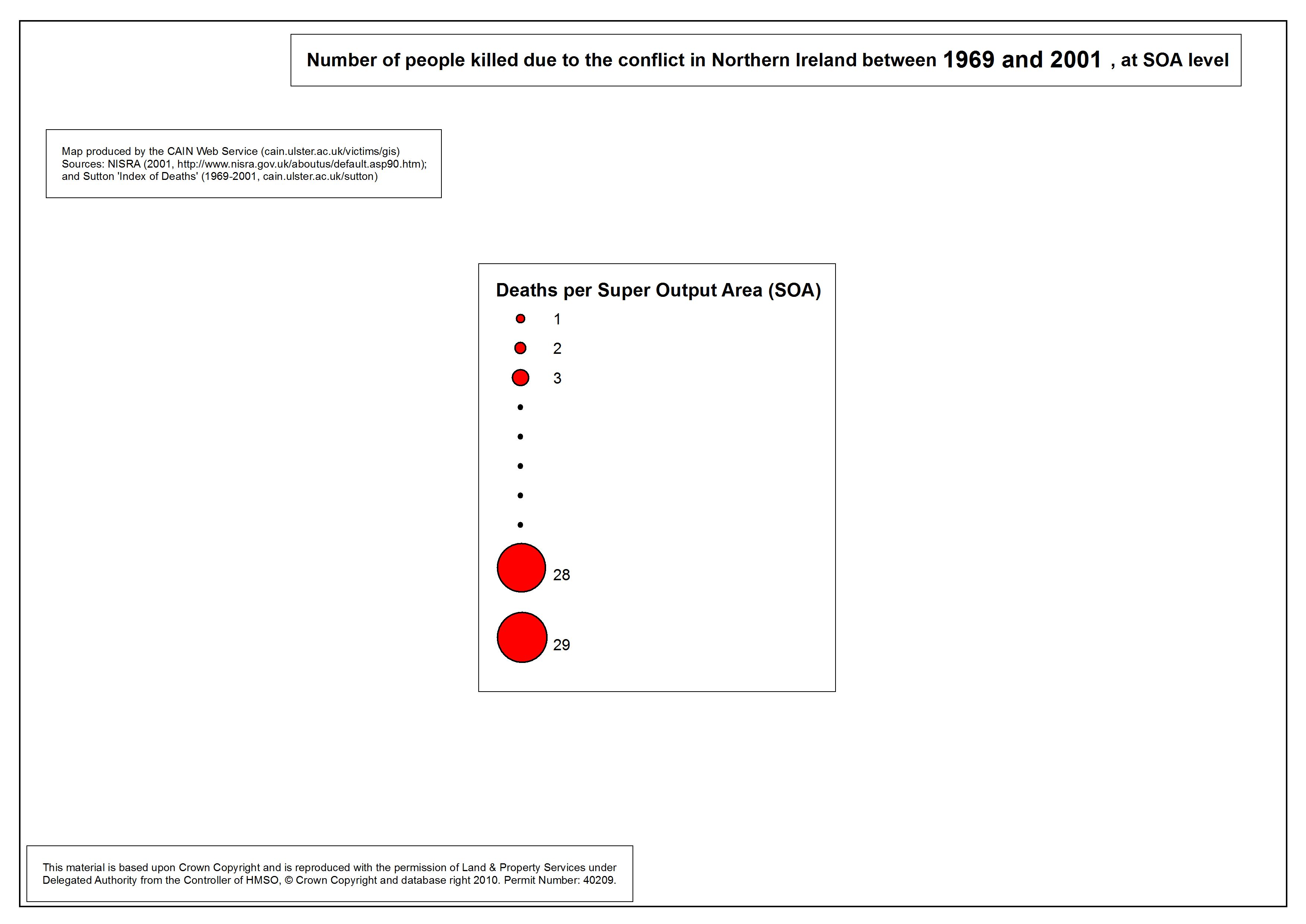
 Legend Legend
Legend for following maps |
.pdf
285kb |
.jpg
39kb |
.jpg
250kb |
 Number killed - NI - SOA - 1969 Number killed - NI - SOA - 1969
Number of people killed due to the conflict in Northern Ireland, 1969, at SOA |
.pdf
320kb |
.jpg
53kb |
.jpg
327kb |
 Number killed - NI - SOA - 1970 Number killed - NI - SOA - 1970
Number of people killed due to the conflict in Northern Ireland, 1970, at SOA |
.pdf
320kb |
.jpg
53kb |
.jpg
328kb |
 Number killed - NI - SOA - 1971 Number killed - NI - SOA - 1971
Number of people killed due to the conflict in Northern Ireland, 1971, at SOA |
.pdf
327kb |
.jpg
55kb |
.jpg
339kb |
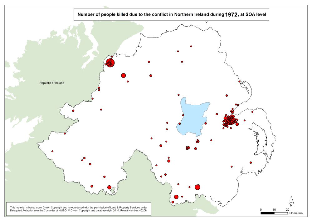
 Number killed - NI - SOA - 1972 Number killed - NI - SOA - 1972
Number of people killed due to the conflict in Northern Ireland, 1972, at SOA |
.pdf
345kb |
.jpg
61kb |
.jpg
372kb |
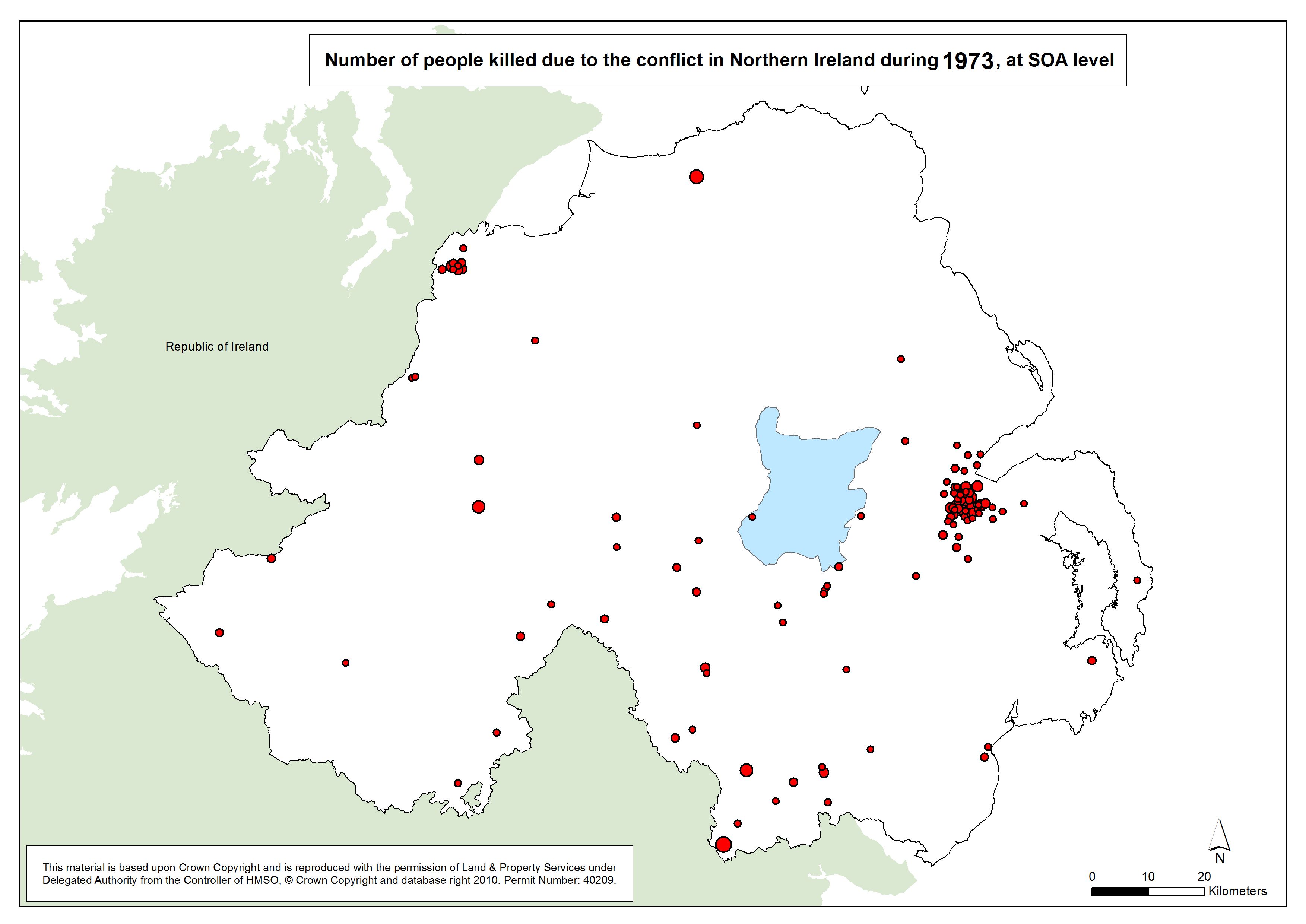
 Number killed - NI - SOA - 1973 Number killed - NI - SOA - 1973
Number of people killed due to the conflict in Northern Ireland, 1973, at SOA |
.pdf
341kb |
.jpg
60kb |
.jpg
363kb |
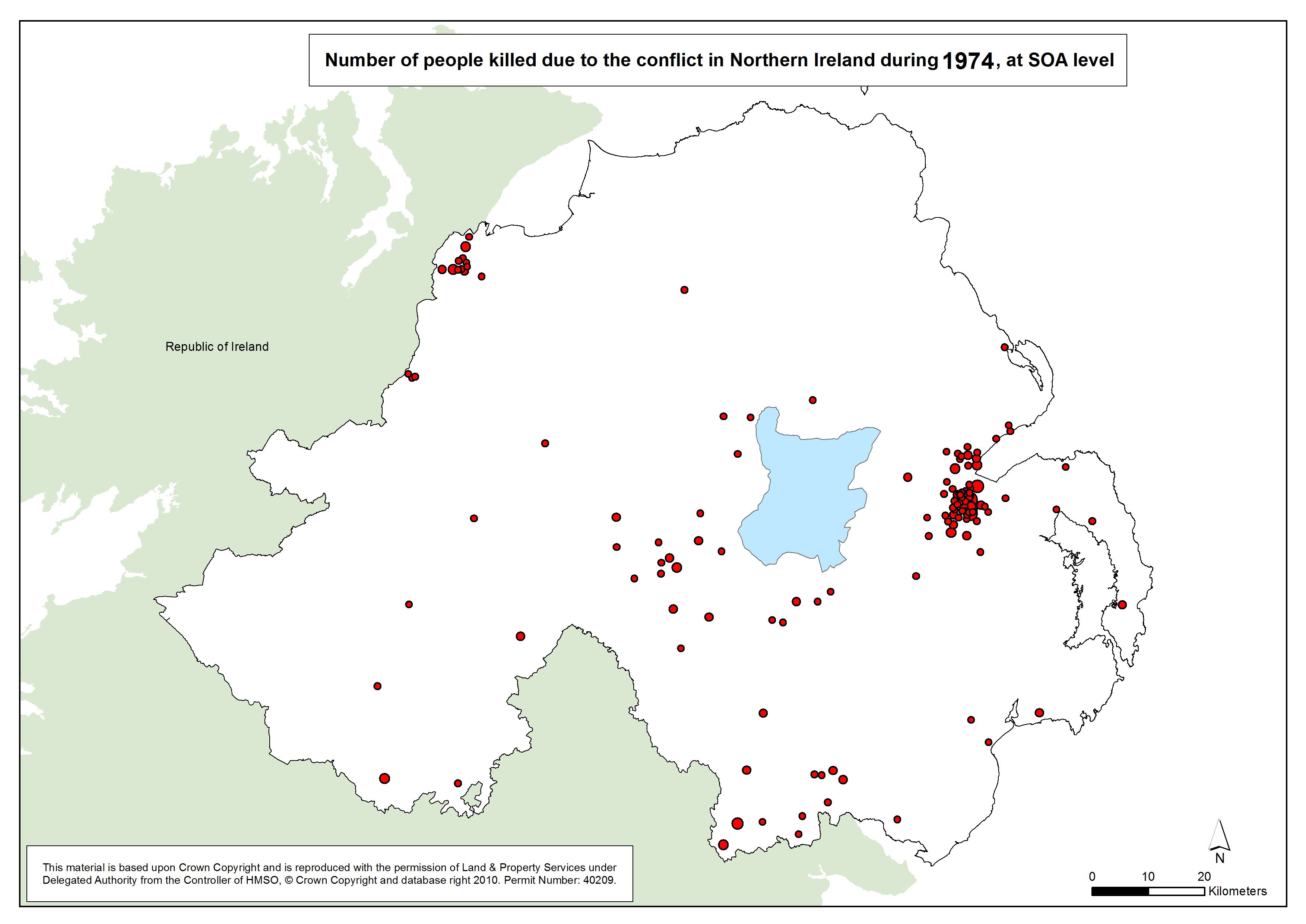
 Number killed - NI - SOA - 1974 Number killed - NI - SOA - 1974
Number of people killed due to the conflict in Northern Ireland, 1974, at SOA |
.pdf
345kb |
.jpg
61kb |
.jpg
370kb |
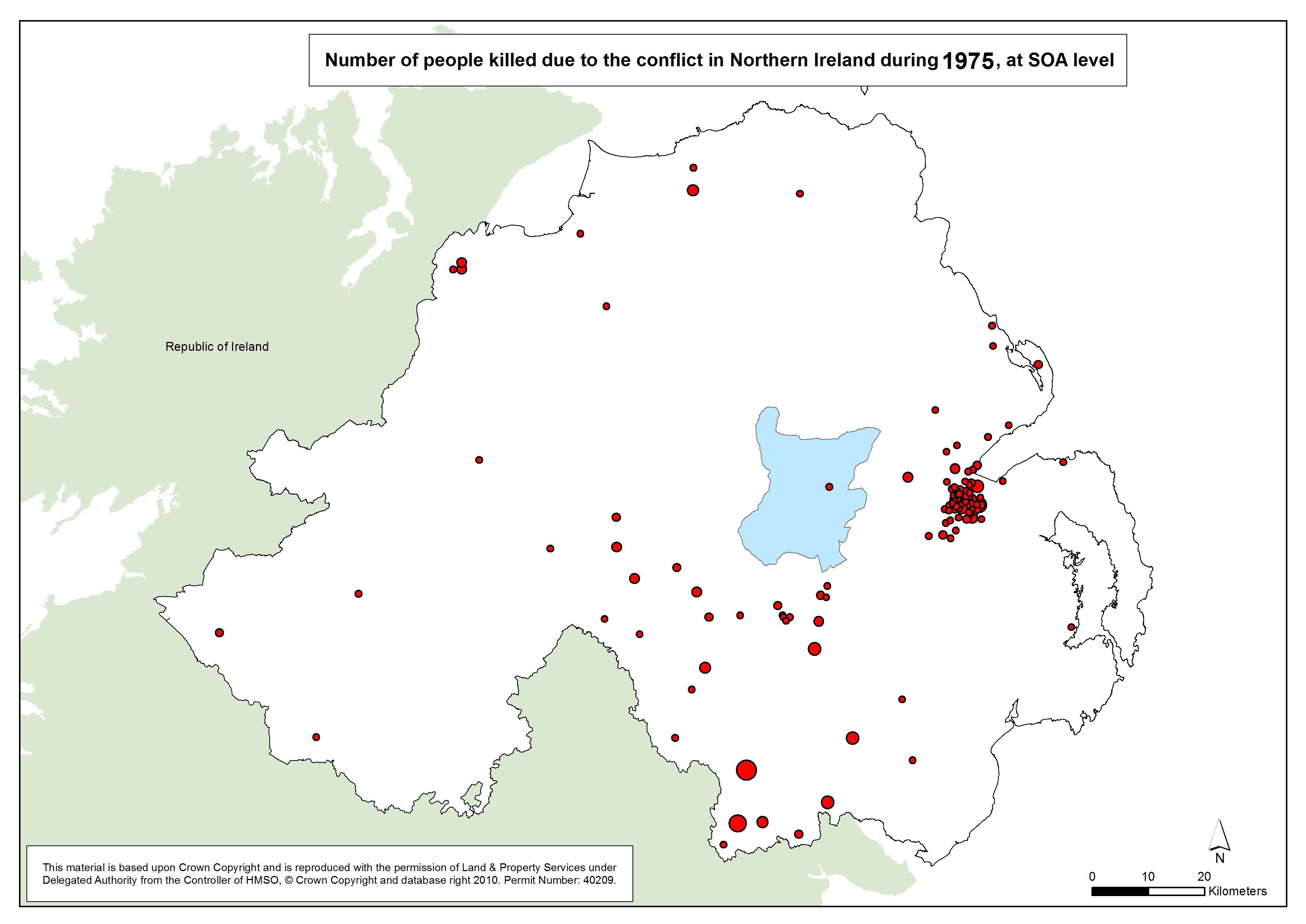
 Number killed - NI - SOA - 1975 Number killed - NI - SOA - 1975
Number of people killed due to the conflict in Northern Ireland, 1975, at SOA |
.pdf
341kb |
.jpg
60kb |
.jpg
363kb |
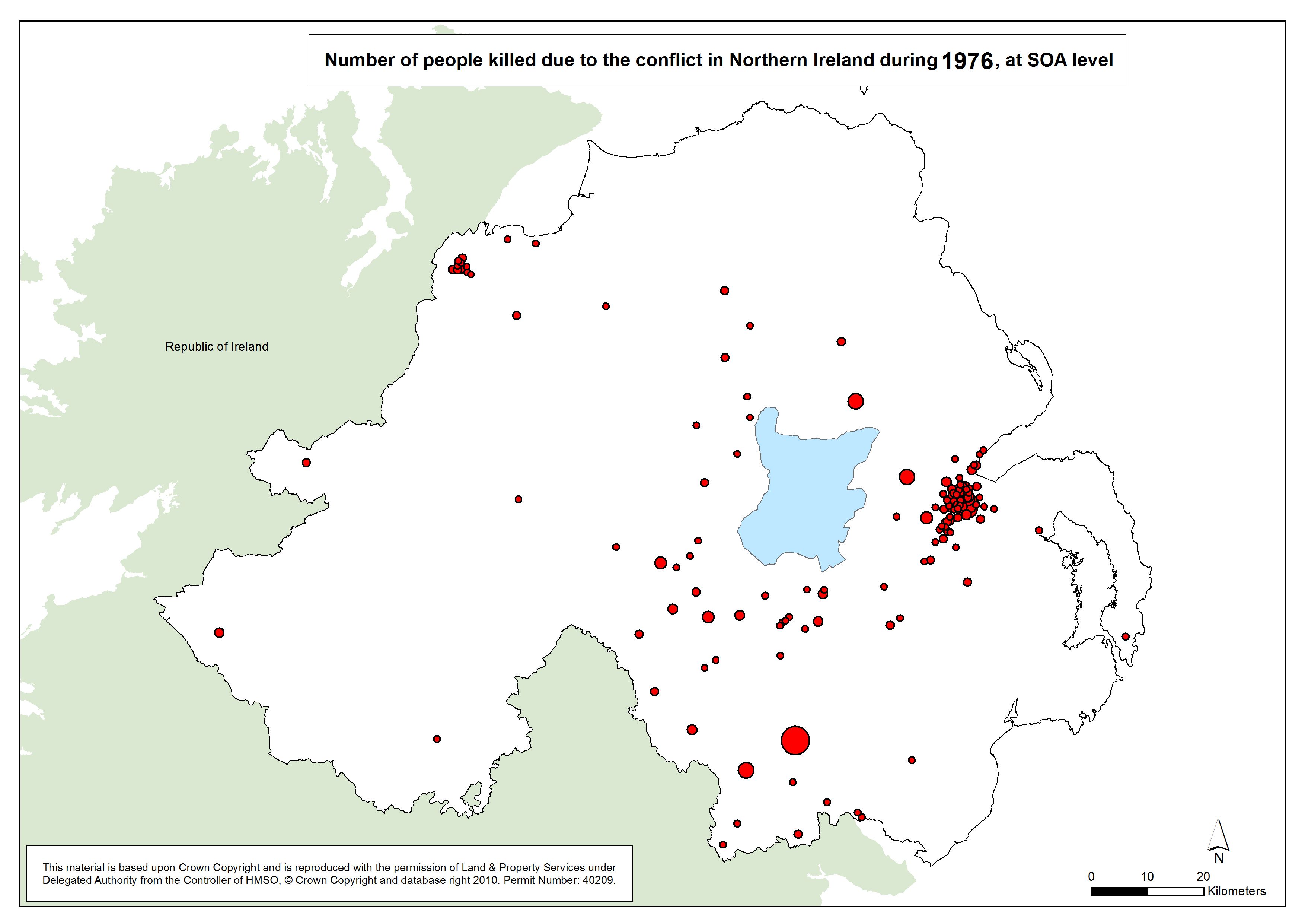
 Number killed - NI - SOA - 1976 Number killed - NI - SOA - 1976
Number of people killed due to the conflict in Northern Ireland, 1976, at SOA |
.pdf
347kb |
.jpg
62kb |
.jpg
373kb |
 Number killed - NI - SOA - 1977 Number killed - NI - SOA - 1977
Number of people killed due to the conflict in Northern Ireland, 1977, at SOA |
.pdf
332kb |
.jpg
57kb |
.jpg
348kb |
 Number killed - NI - SOA - 1978 Number killed - NI - SOA - 1978
Number of people killed due to the conflict in Northern Ireland, 1978, at SOA |
.pdf
330kb |
.jpg
56kb |
.jpg
345kb |
 Number killed - NI - SOA - 1979 Number killed - NI - SOA - 1979
Number of people killed due to the conflict in Northern Ireland, 1979, at SOA |
.pdf
332kb |
.jpg
57kb |
.jpg
348kb |
 Number killed - NI - SOA - 1980 Number killed - NI - SOA - 1980
Number of people killed due to the conflict in Northern Ireland, 1980, at SOA |
.pdf
330kb |
.jpg
56kb |
.jpg
345kb |
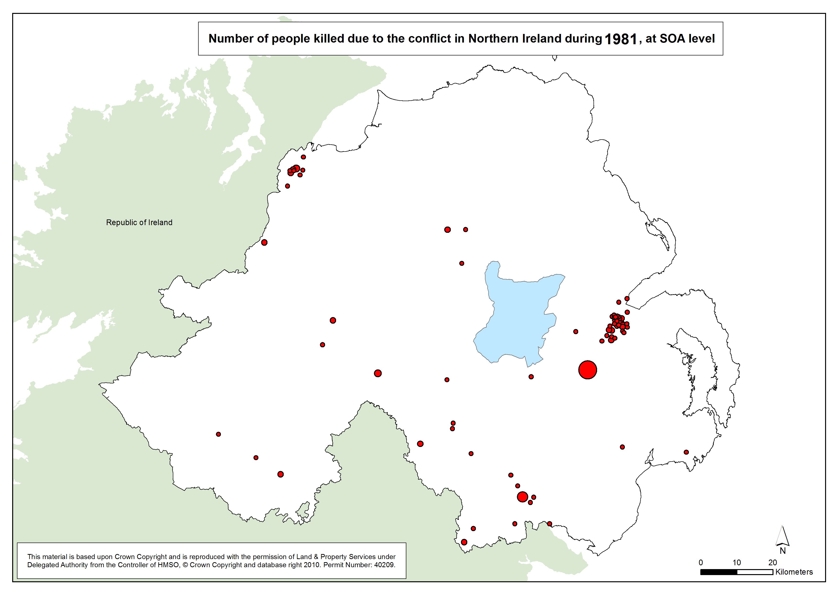
 Number killed - NI - SOA - 1981 Number killed - NI - SOA - 1981
Number of people killed due to the conflict in Northern Ireland, 1981, at SOA |
.pdf
333kb |
.jpg
57kb |
.jpg
350kb |
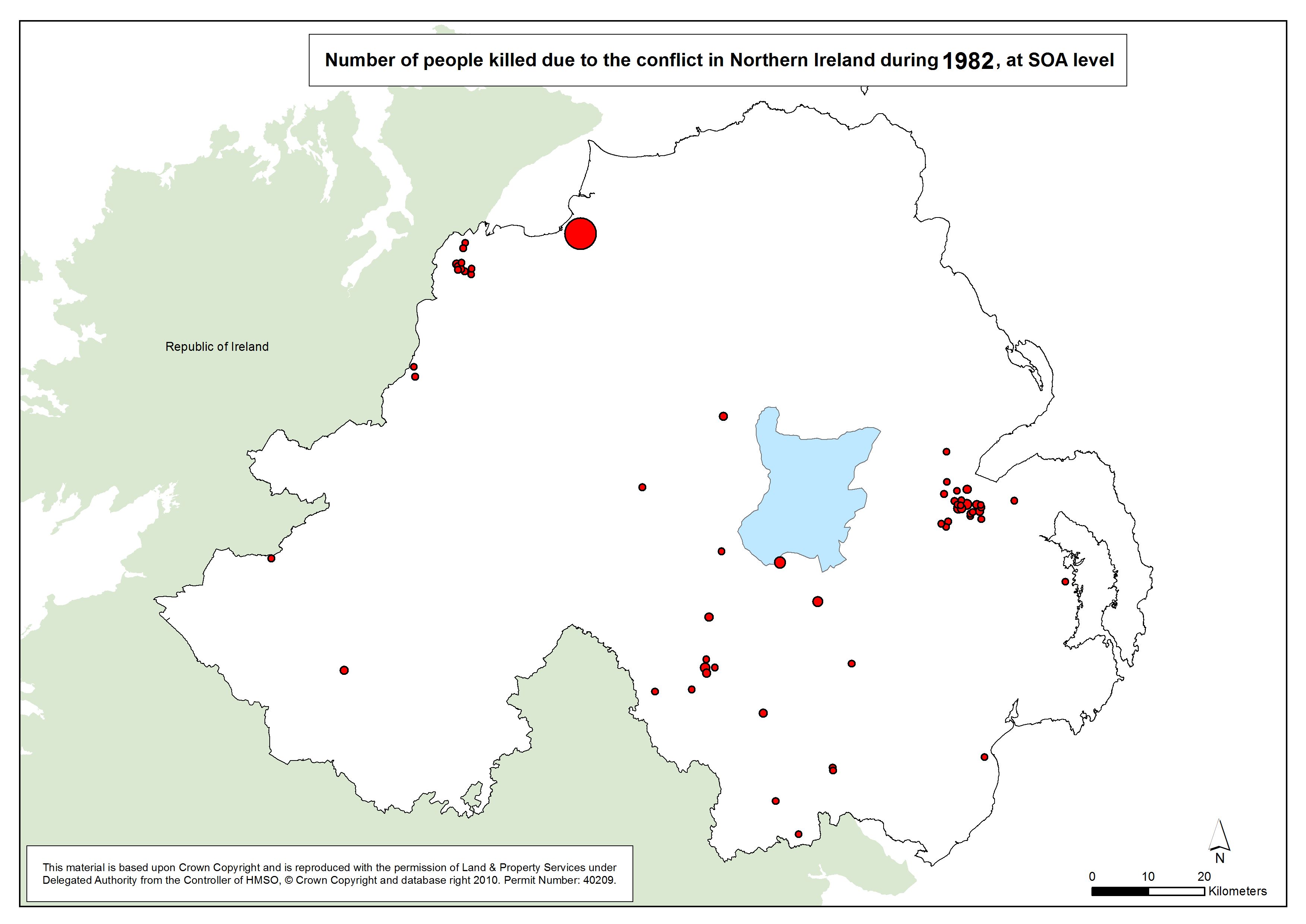
 Number killed - NI - SOA - 1982 Number killed - NI - SOA - 1982
Number of people killed due to the conflict in Northern Ireland, 1982, at SOA |
.pdf
331kb |
.jpg
56kb |
.jpg
346kb |
 Number killed - NI - SOA - 1983 Number killed - NI - SOA - 1983
Number of people killed due to the conflict in Northern Ireland, 1983, at SOA |
.pdf
333kb |
.jpg
57kb |
.jpg
349kb |
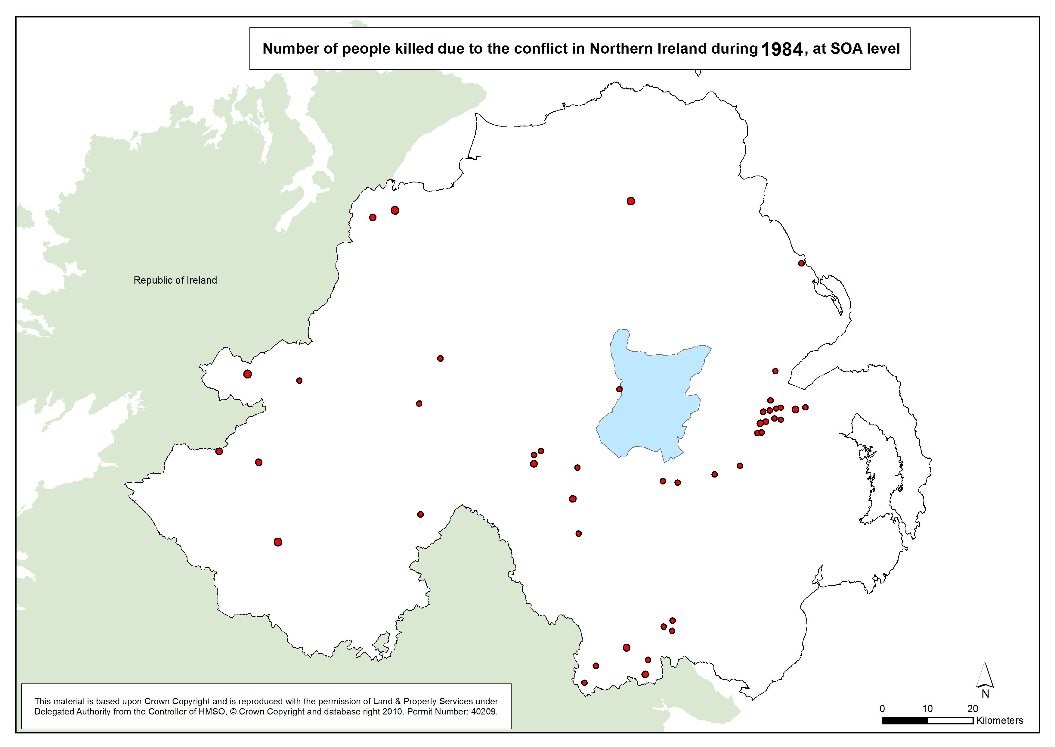
 Number killed - NI - SOA - 1984 Number killed - NI - SOA - 1984
Number of people killed due to the conflict in Northern Ireland, 1984, at SOA |
.pdf
330kb |
.jpg
56kb |
.jpg
344kb |
 Number killed - NI - SOA - 1985 Number killed - NI - SOA - 1985
Number of people killed due to the conflict in Northern Ireland, 1985, at SOA |
.pdf
327kb |
.jpg
55kb |
.jpg
339kb |
 Number killed - NI - SOA - 1986 Number killed - NI - SOA - 1986
Number of people killed due to the conflict in Northern Ireland, 1986, at SOA |
.pdf
329kb |
.jpg
56kb |
.jpg
342kb |
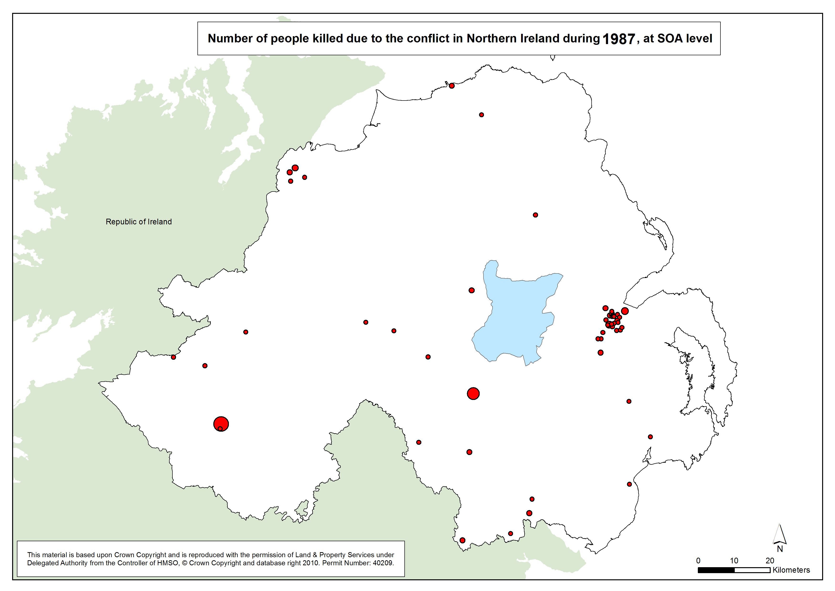
 Number killed - NI - SOA - 1987 Number killed - NI - SOA - 1987
Number of people killed due to the conflict in Northern Ireland, 1987, at SOA |
.pdf
330kb |
.jpg
56kb |
.jpg
344kb |
 Number killed - NI - SOA - 1988 Number killed - NI - SOA - 1988
Number of people killed due to the conflict in Northern Ireland, 1988, at SOA |
.pdf
330kb |
.jpg
56kb |
.jpg
345kb |
 Number killed - NI - SOA - 1989 Number killed - NI - SOA - 1989
Number of people killed due to the conflict in Northern Ireland, 1989, at SOA |
.pdf
329kb |
.jpg
56kb |
.jpg
343kb |
 Number killed - NI - SOA - 1990 Number killed - NI - SOA - 1990
Number of people killed due to the conflict in Northern Ireland, 1990, at SOA |
.pdf
330kb |
.jpg
56kb |
.jpg
345kb |
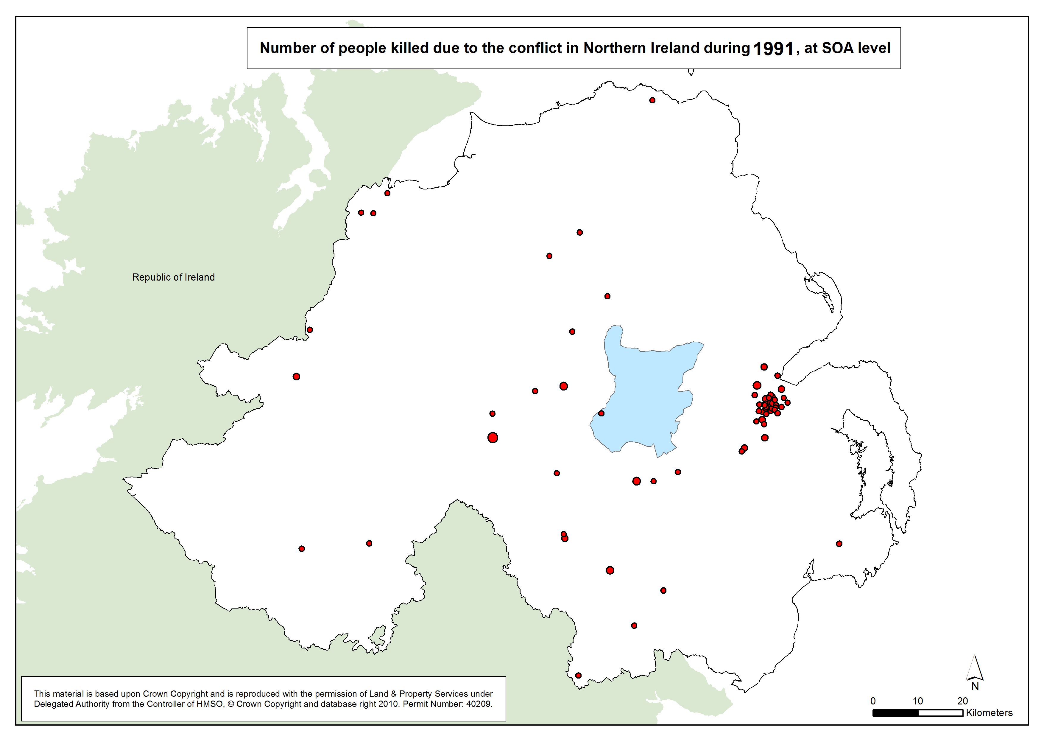
 Number killed - NI - SOA - 1991 Number killed - NI - SOA - 1991
Number of people killed due to the conflict in Northern Ireland, 1991, at SOA |
.pdf
331kb |
.jpg
56kb |
.jpg
346kb |
 Number killed - NI - SOA - 1992 Number killed - NI - SOA - 1992
Number of people killed due to the conflict in Northern Ireland, 1992, at SOA |
.pdf
329kb |
.jpg
56kb |
.jpg
343kb |
 Number killed - NI - SOA - 1993 Number killed - NI - SOA - 1993
Number of people killed due to the conflict in Northern Ireland, 1993, at SOA |
.pdf
331kb |
.jpg
56kb |
.jpg
345kb |
 Number killed - NI - SOA - 1994 Number killed - NI - SOA - 1994
Number of people killed due to the conflict in Northern Ireland, 1994, at SOA |
.pdf
328kb |
.jpg
55kb |
.jpg
341kb |
 Number killed - NI - SOA - 1995 Number killed - NI - SOA - 1995
Number of people killed due to the conflict in Northern Ireland, 1995, at SOA |
.pdf
320kb |
.jpg
53kb |
.jpg
327kb |
 Number killed - NI - SOA - 1996 Number killed - NI - SOA - 1996
Number of people killed due to the conflict in Northern Ireland, 1996, at SOA |
.pdf
321kb |
.jpg
53kb |
.jpg
328kb |
 Number killed - NI - SOA - 1997 Number killed - NI - SOA - 1997
Number of people killed due to the conflict in Northern Ireland, 1997, at SOA |
.pdf
323kb |
.jpg
54kb |
.jpg
332kb |
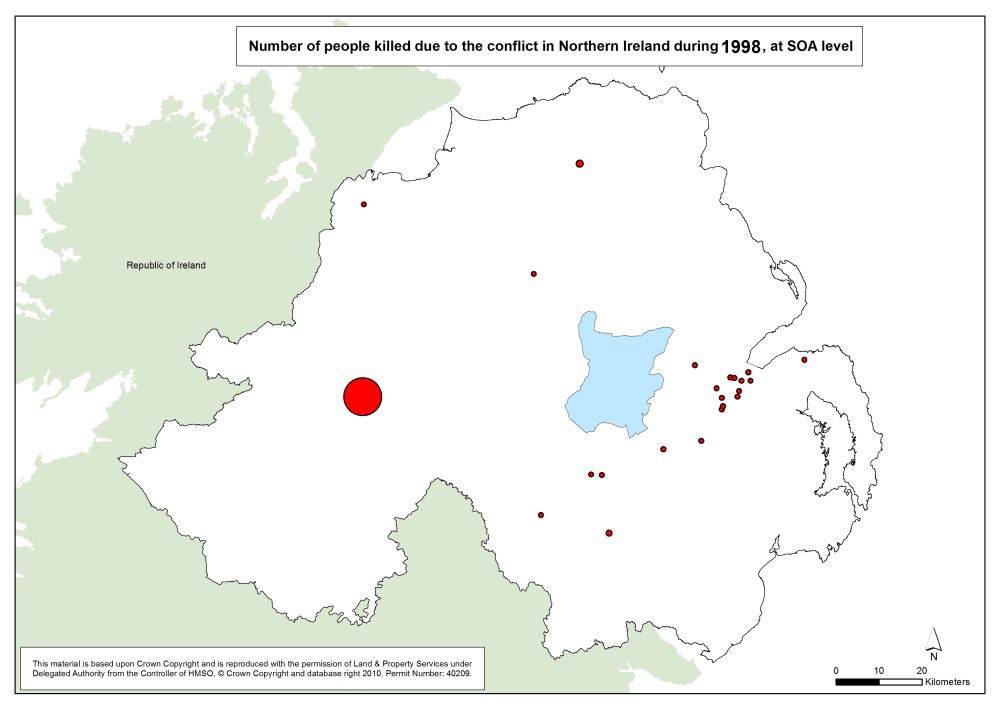
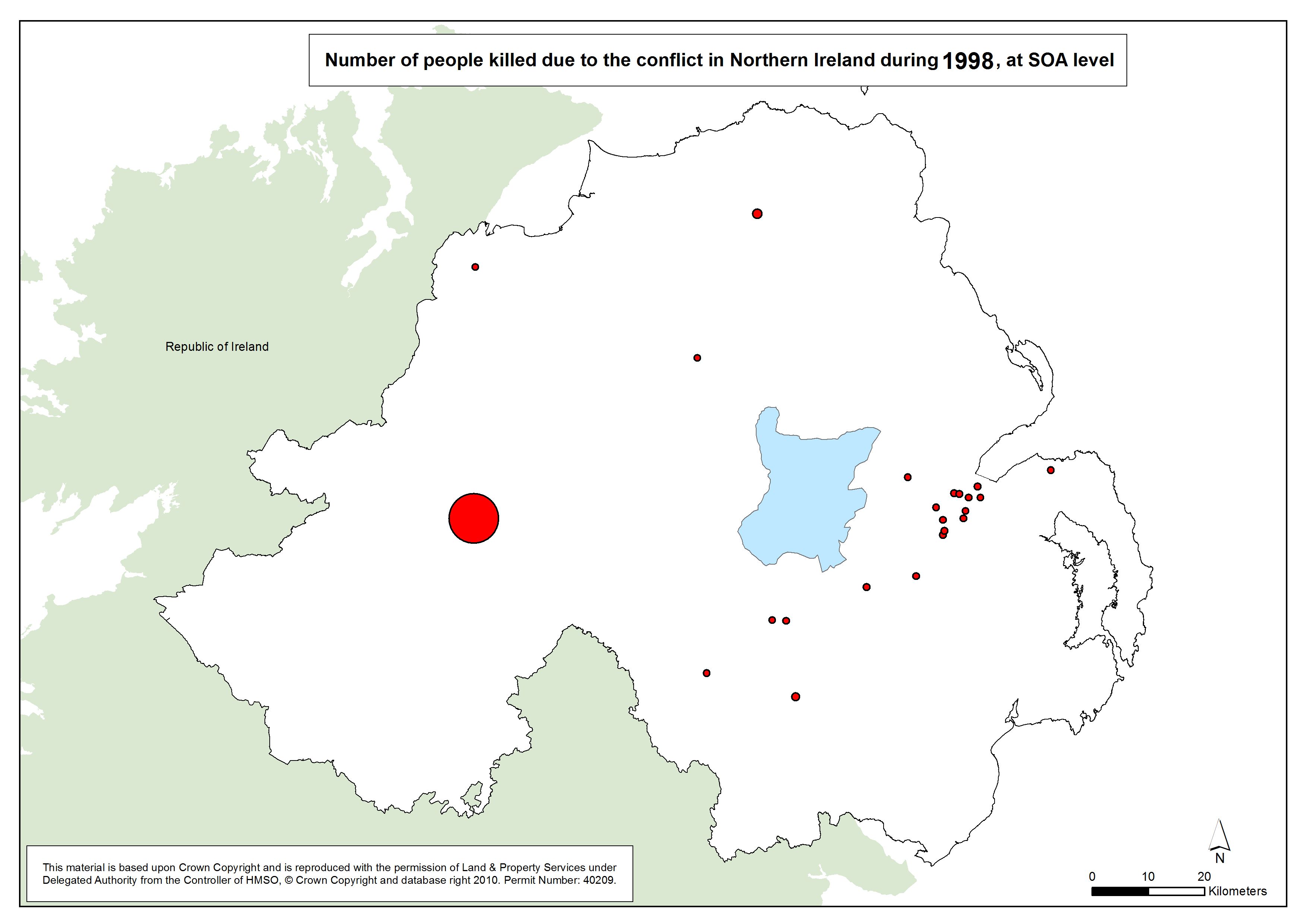
 Number killed - NI - SOA - 1998 Number killed - NI - SOA - 1998
Number of people killed due to the conflict in Northern Ireland, 1998, at SOA |
.pdf
326kb |
.jpg
55kb |
.jpg
337kb |
 Number killed - NI - SOA - 1999 Number killed - NI - SOA - 1999
Number of people killed due to the conflict in Northern Ireland, 1999, at SOA |
.pdf
320kb |
.jpg
53kb |
.jpg
327kb |
 Number killed - NI - SOA - 2000 Number killed - NI - SOA - 2000
Number of people killed due to the conflict in Northern Ireland, 2000, at SOA |
.pdf
321kb |
.jpg
53kb |
.jpg
330kb |
 Number killed - NI - SOA - 2001 Number killed - NI - SOA - 2001
Number of people killed due to the conflict in Northern Ireland, 2001, at SOA |
.pdf
322kb |
.jpg
53kb |
.jpg
330kb |
Number killed - NI - SOA - 1969-2001
Number of people killed due to the conflict in Northern Ireland, 1969-2001, at SOA |
.pdf
525kb |
.jpg
112kb |
.jpg
679kb |
| Animation - Number of people killed due to the conflict in Northern Ireland, by year (1969-2001), at SOA (Small Output Area) (1 animation based on 34 maps) |
| Title of Animation |
File Version |
| GIF |
|
|
Animation - Number killed - NI - SOA - 1969-2001
Animation Gif of Number of people killed due to the conflict in Northern Ireland, 1969-2001, at SOA |
.gif
3785kb |
|
|
|
